


Price: 36,950.00 USD
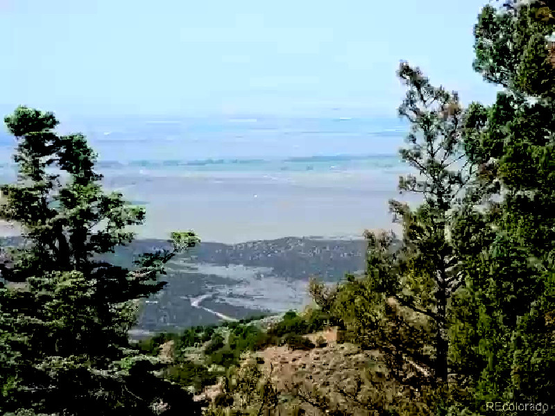
16.47 ACRES WOODED MOUNTAIN LAND, FORT GARLAND, SANGRE DE CRISTO RANCHES, CO
IMPORTANT NOTE
PLEASE READ THE ENTIRE LISTING, PERFORM ALL DUE DILIGENCE AND ASK ALL YOUR QUESTIONS
If you have less than 6 feedback, please contact us before using the Buy It Now. Thank you very much for your understanding, sorry for the inconvenience if any
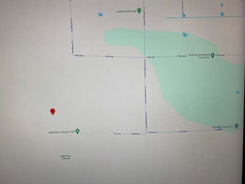
16.47 acres located in 5543 Balleroy Road in Sangre De Cristo Ranches, Fort Garland, Colorado
The land has legal access and a dirt road frontage
The property is surveyed, the plat map has been recorded with the county
Cash Sale or Financed with $700.00 down payment towards the price of $36,950,00. We will finance for 10 years at 6.9% APR $419.03 per month, for 7 years at 6.5% APR $538.29 per month or for 5 years at 5.9% APR $699.13 per month, the monthly payment will be lower with a higher down payment, buyer will pay $250. for document preparation fee, please see terms for more details
Every one qualify, no credit checks, no hassles
_11.png?width=1920&height=1080&fit=bounds)
We Have a Title Insurance Free and Clear of Liens or Encumbrances
_7.png?width=1920&height=1080&fit=bounds)
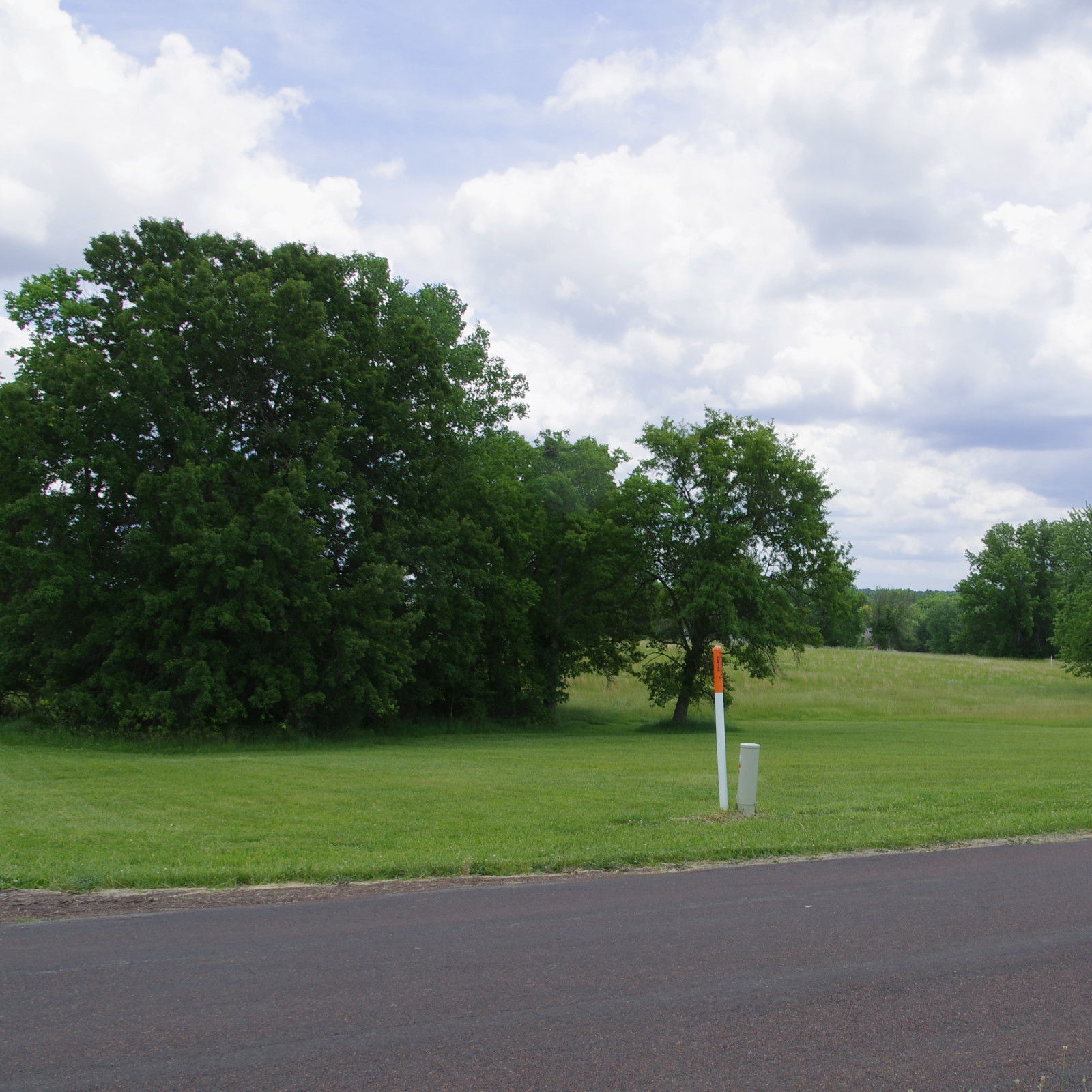
The land is surrounded by 1,000’s of acres of wooded lands
_9.png?width=1920&height=1080&fit=bounds)
Near towns, attractions, mountains, parks, lakes, rivers and wildlife
_(edited)_1(1).png?width=1920&height=1080&fit=bounds)
Beautiful and Peaceful Land, lots of Privacy. Captivating night skies for star gazing and relaxing
_12(2).png?width=1920&height=1080&fit=bounds)
Excellent location, near towns, attractions, mountains, parks, lakes, rivers and much more
_8.png?width=1920&height=1080&fit=bounds)
Land with beautiful views of the valley, mountains and hills
_4.png?width=1920&height=1080&fit=bounds)
Property Information
| ~ Legal Description | Lot 5543, Block 253, Sangre de Cristo Ranches, Unit T-2 |
| ~ Town | Fort Garland |
| ~ State | Colorado |
| ~ County | Costilla |
| ~ Size | 16.47 acres |
| ~ Zoning | Residential: Min built size home 600 Sq. Ft, manufactured possible w/permit |
| ~ Location | 5533 Balleroy Road, Fort Garland Colorado |
| ~ Survey | Yes |
| ~ Access | Legal access. State county paved, county maintained gravel/dirt road frontage |
| ~ Approx. Coordinates | NE corner 37.2917 -105.3289 NW corner 37.2922 -105.3334 SE corner 37.2897 -105.3304 SW corner 37.2900 -105.3316 |
| ~ Vegetation | Pinon pine trees, sage grasses, evergreen and wild flowers |
| ~ Title | Free and clear of any lien |
| ~ Water | By well, water haul, cistern to be done by buyer |
| ~ Power | By solar to be done by buyer |
| ~ Septic System | To be done by the buyer |
| ~ Property Taxes | About $358.00 per year |
| ~ Price | $36,950. cash or financing |
|
~ Documentation Fee |
For owner financing $700 down payment, $250 document preparation fee, a contract for deed will be used, see terms for more info For Cash Sale $250 for document preparation done by the seller and recording fee, or the closing could be done by a title company, Buyer will pay for the title insurance policy and buyer’s closing fees |
Property Description
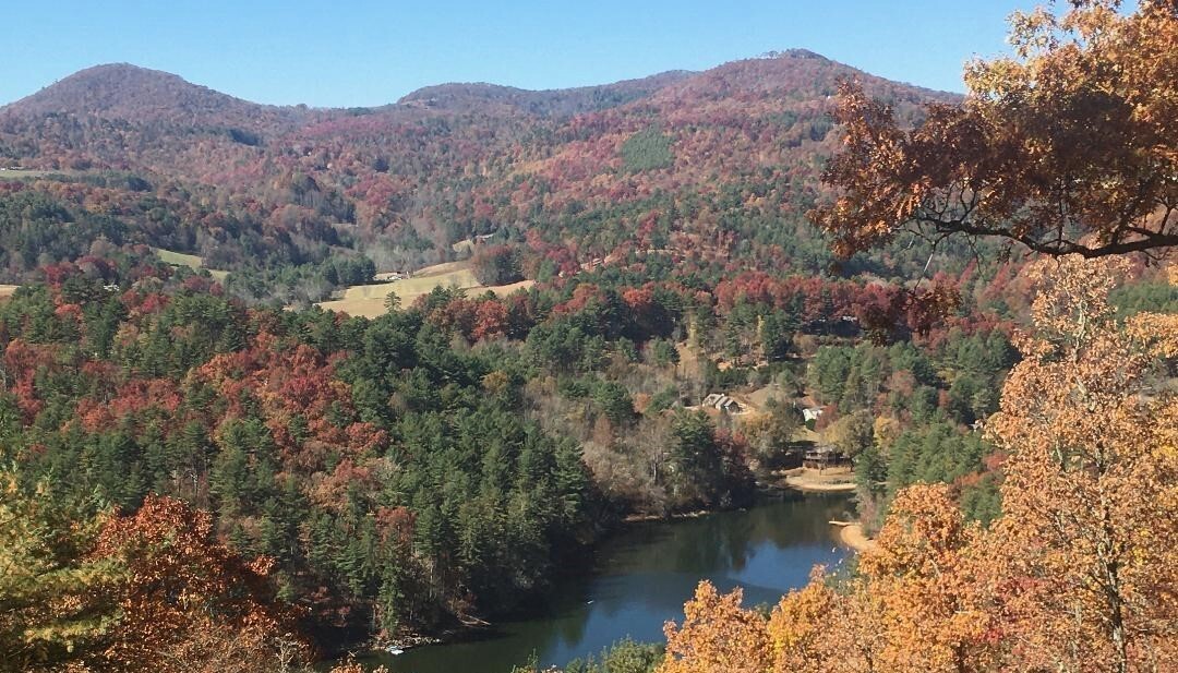
This is for you! A high country lot with amazing views of the valley! 16.47 acres of nature Pine and Aspen trees throughout the property. This is an incredible mountainous piece of land ideal place for people who like to enjoy a private lifestyle. There are breath taking views of the valley and the mountains, so far your eyes could see. Escape to your own forest, to your summer house or to your cabin. Great summer getaway, depending on the weather, the yearly access can be from 6 to 9 months, and an average of 285 sunny days per year. A peaceful land, away from the traffic and city stress, to experience nature, fresh air and slow down the tempo. Located in Sangre De Cristo Ranches, 5543 Balleroy Road, Fort Garland, CO 81133.
The parcel has legal access and road frontage. It is surveyed, the plat map has been recorded with the county. The land is wooded with Pine and Aspen trees, evergreen, wild flowers, and a beautiful rural mountainous southern exposure terrain. This is a raw undeveloped beauty, with a nice topography of flat, rolling spots, slope and steep down hill, with a few beautiful building areas. The elevation is approximately 8,715 ft. to 10,140 ft. It is surrounded by 1000’s acres of wooded lands and some open spaces.
The property is located about 16 miles south from Fort Garland, a 34 minute drive and 16 miles north of San Louis, a 34 minute drive. The land is about 13 miles away, about 32 minute drive to Mountain Home Reservoir and to Smith reservoir 18 miles, about 45 minute drive, both reservoirs with good areas for BBQ, picnic, great fishing, swimming, camping, and boating. From 0 to 50 miles you can find several scenic byways to national parks, state parks, Mountains, lakes, rivers, reservoirs and creeks, this area has it all!
The lot is zoned residential and allows to build a house, minimum 600 Sq. Ft, for manufactured home an extra community permit needed. Buyer will have to provide septic system, and water by well, cistern or haul water. You need a permit to build, while you build, you can live there in a mobile home for up to a year. They are a few scattered homes in the area.
There is hunting, fishing, boating, hiking, ATV, skiing and fishing in the surrounding area and a variety of wildlife including elk, deer, mule, pronghorn, birds, please contact Colorado Parks and Wildlife for hunting and fishing information. Fort Garland has a business district with hotels, several restaurants, gas stations, grocery stores, liquor store, hardware store, hair salon, car wash, U-Haul dealer, hardware dealer, appliance store, work art gallery, antique store, post commissary, museum and multiple shops featuring collectibles, antiquities as well as wild west show. In Alamosa is a Walmart and Home Depot. Other towns near the property are the Town of Blanca is about 21.7 miles west and Alamosa is 47miles west, both towns are at Hwy 160.
Terms
The property is sold on “as is” condition. The sale is final. All information included in this listing has come from reliable sources and is accurate to the best of our knowledge but not guaranteed, we do not have more information, other than described. Seller does not make any warranties expressed or implied, nor assumes any liability whatsoever to include without limitation, soil conditions, drainage, build ability or accessibility regarding this property. We do guarantee free and clear title with no liens. Taxes are currently paid.
You are required to read the entire listing, to perform all due diligence and to ask all questions. By using the Buy It Now you acknowledge and agree that you have done all your due diligence on the property.
CASH SALE OR SELLER’S FINANCING with $700.00 down payment towards the price of $36,950,00. We will finance for 10 years at 6.9% APR $419.03 per month, for 7 years at 6.5% APR $538.29 per month or for 5 years at 5.9% APR $699.13 per month. Buyer will pay $250 document preparation fee, the monthly payment will be lower with a higher down payment, no prepayment penalty, no credit check. Monthly payments to be done by Zelle.
BUYER please ESTABLISH CONTACT with the SELLER right AFTER USING the BUY It NOW and PROVIDE PICTURE ID, the NAME in which the AGREEMENT will be on, ADDRESS, EMAIL ADDRESS, TELEPHONE NUMBER, and please let us know for how many years you want the financing. Down payment and document preparation fee to be received within 3 days by Zelle.
CASH SALE: Buyer will pay $250 for document preparation done by the seller and recording fee. Full payment to be received within 4 days by cashier’s check. Or the closing could be done by a title company, buyer will pay for title insurance policy and for buyer’s closing fees.
Activities
Activities in the area include hunting, camping, swimming, hiking, skiing, fishing, bird watching, ATV’S playground, mountain biking, horse riding, kayaking, snowmobiling, water rafting, golfing and other attractions.
Mountain Home Reservoir approximately 13 miles from the property

Mountain Home Reservoir is a great place for relaxation, swimming, boating, fishermen will find a variety of fish including smallmouth bass, northern pike, bream, bluegill, largemouth bass, rainbow trout and walleye here. Whether you’re bait casting, spinning or fly fishing your chances of getting a bite here are good. So grab your favorite fly fishing rod and reel, and head out to Mountain Home Reservoir. For Fishing License purchase, fishing rules, and fishing regulations please visit Colorado Parks and Wildlife.
Smith Reservoir, approximately 18 miles from the property

Smith Reservoir is located in San Luis Valley, just south of Blanca. It is a great place for relaxation, swimming, boating and used extensively for fishing rainbow trout, channel catfish, pike, bass and for camping. Mt. Blanca dominates the view to the north of the reservoir.
Smith Reservoir is the greatest redeeming feature of Costilla County. During the spring and fall there are usually large duck flocks with many species, and more shorebird species have been seen here than anywhere else in the county. Even rarities have shown up here, such as Whimbrel and Short-billed Dowitcher. The roads nearby are often good for hawks, including Ferruginous. A few trees may have sparrows or other land bird migrants.

Approximated Distances in Miles from Property
Fort Garland 16, Blanca 20, San Luis 16, Alamosa 41, Smith Reservoir 18, Mountain Home Reservoir 13, Monte Vista National Refuge 60, Alamosa National Wildlife Refuge 41, Baca National Wildlife Refuge 72, Great Sand Dunes National Park 59, Walsenburg 64, Pueblo 112, Colorado Springs 157, Denver 226.
Town of Fort Garland 16 miles south west from the property

Fort Garland is a “census-designated place” located on US 160 in the San Luis Valley of southern Colorado, 13.1 miles south west of the property. The town consists of maybe 400 people settled at a crossroad. It is a town with a few gas stations, a couple of restaurants and convenience stores, museum and visitor center and several other businesses along the highway. The town of Blanca is 17.1 miles further west. The two towns share their community center and their schools. The two towns are nearly surrounded by Forbes developments (Forbes Trinchera, Forbes Wagon Wheel, Sangre de Cristo Ranches, etc.)
Today you can walk the parade ground of the fort and tour the adobe buildings. The Commandant’s Quarters features a re-creation of the quarters during Carson’s time. Fort Garland also highlights the folk art and culture of the Hispanic community in southern Colorado.
Town of Blanca about 20 miles west from the property

It is a town with churches, general store, convenience store, post office, cafes, restaurants, lounge, gallery, mechanic, RV park, hair salon, laundry, school and day care, Blanca-Fort Garland Community Center, town hall, police department, and a supply store.
Town of San Luis is 16 miles south from the property

San Luis is the county seat of Costilla County, is located on Colorado Highway 159 in the San Luis Valley of southern Colorado, about 30.7 miles south from the land. A picturesque town, it lies at the mouth of the valley of the Ventero, at the foot of Culebra Peak. San
San Luis, the oldest town in Colorado, was established on April 5, 1851, with a present population of approximately 750. San Luis is predominately Hispanic, with strong ties to Spain’s religious, cultural, and artistic traditions. Once a part of four Spanish land grants decreed by the King of Spain, the town’s adobe architecture and classic Spanish town layout retain the texture of the historical and cultural influences which shaped the early communities of Southern Colorado. The surrounding area is mainly a farming and agriculture area.
San Luis has an exceptional tourist attraction, The Stations of the Cross Shrine. These sculptors are ¾ to life size bronze statues of the 15 stations of the cross with the resurrection being the 15th. The Shrine is located on a mesa (flat top mountain) in the center of San Luis where we have recreated our own Calvary. The Shrine of the Stations of the Cross was built as an act of faith and love by the parishioners of the Sangre de Cristo Parish in San Luis, Colorado. We want a place of prayer and solace open to members of all faiths and good will and hope that those visiting will find consolation and peace in your life.
The setting of San Luis is beautiful: surrounded by lush green fields at the foot of the Sangre de Cristo Mountains on the east. Just to the south and east of San Pedro Mesa is Sanchez Reservoir and Sanchez State Wildlife Area. Just to the west are the San Luis Hills with the San Juan Mountains acting as a backdrop. To the north is the Blanca Massif.
Town of Alamosa 41 miles north from the property

Alamosa is surrounded by rugged mountain peaks and numerous recreation opportunities including the City owned Cattails Golf Course. The Rio Grande Scenic Railroad provides excursion trains from Alamosa to La Veta and a connection to the Cumbres and Toltec Railway. The train route takes you through breathtaking country you can’t see from the highway. Home to Adams State College and Trinidad State Junior College, higher education opportunities and cultural events abound. The Sand Dune National Park offers one of the most unique and diverse national parks. With soaring peaks, wetlands, tundra, and the tallest sand dunes in North America, there is much to do and see. With many hotels and restaurants the City of Alamosa is a wonderful place to stay as you enjoy the San Luis Valley, it has as well numerous stores, super markets, churches, movie theaters, bowling alleys, restaurants and lounges, banks, a saving and loan association, and camping facilities.
Costilla County
Costilla County was the first area of the state of Colorado to be colonized with recorded history dating back to 1540, the year Coronado explored the Southwest. It is home to the oldest town in Colorado, San Luis. Costilla County has two incorporated towns and several smaller communities. The towns of San Luis and Blanca are incorporated while Fort Garland is one of the county’s larger towns though not incorporated. Chama, San Pedro, Los Fuertes, Garcia, Jaroso, San Francisco, San Acacio, and Mesita, are smaller communities, all of which were established shortly after the town of San Luis in 1851.
The county also has a few reservoirs: East dale Reservoir; Sanchez Reservoir, Smith Reservoir, and Mountain Home Reservoir. All are excellent for fishing and boating. One may catch walleye, pike, and several species of trout, bass, and a few other types of fish. Costilla County is also home to much wildlife such as deer, elk and antelope, which may often be seen in herds grazing in the fields. Coyotes, bears, bighorn sheep, and mountain lions also make their homes here. Costilla County
offers some of the best big game hunting in Colorado.
The Town of San Luis is home to the Stations of the Cross Shrine. The Shrine sits on top of a mesa in the center of San Luis. The shine represents the last hour of Christ’s life, to his resurrection. Attracting thousands of guests a year, visitors come to pray and bring peace to themselves. Every year, hundreds of people walk from as far as Pueblo, CO, to the Stations of the Cross Shrine in what is known as a pilgrimage. All of the sculptures of the Stations of the Cross were created by local artist Huberto Maestas, who also has a gallery and sculpting studio in San Luis. Some of his work can also be seen on the Plaza in Taos, NM and at the Jack Dempsey Museum in Manassa, CO. La Capilla de Todas los Santos, a Catholic Chapel also sits above the Stations of the Cross Shrine.
San Luis is home to the Sangre de Cristo Parish Church, which was built in 1886 and to the R&R Supermarket, which is the oldest continuously operating business in Colorado dating back to 1857. At the San Luis Museum and Cultural Center, you can see everything from butterfly and insect collections to steps in pottery making, carnival masks, civil war history, and a replica of a Morada room, as well as a replica of San Luis from 1851. Pictures and murals depict the history of San Luis in the museum. The museum itself was built in the 1930’s, but did not get completed until 1944.
Fort Garland is home to the Fort Garland Museum, which is an old frontier army fort built in 1858. It was once commanded by the famous frontiersman Kit Carson, although he didn’t take over the post until 1866-67. Carson had orders from the government to keep peace in the San Luis Valley; therefore no battles were ever fought on fort grounds. The fort served only as a show of force and a staging area to protect settlers from the Ute Indians. Today it is a museum where you can learn about military history and walk the grounds. Memorial Day weekend the Fort Garland Museum is host to a three day festival of re-enactments, stories, songs, and dances depicting the cultures and occupations indigenous to Costilla County including Hispanic, Ute and fur trapping.
The Town of Blanca is known for its views of Blanca Peak, which stands 14,345 feet tall. Both Blanca and Fort Garland are small communities in Costilla County along Colorado State Highway 160. In these towns, you will find a variety of restaurants, hotels and lodges and gift stores that carry leatherwork, handmade jewelry, souvenirs and Indian crafts.
San Acacio, a small village just west of San Luis, has a church, which is the oldest Christian structure in Colorado built in 1856.
Also in San Luis is 633 acres of communal grazing land called La Vega, which is part of the Sangre de Cristo Land Grant.
Although Costilla is mainly a farming and agriculture county- it still brings visitors by the thousands year round from far and wide.
Historical Towns, Activities and Area Attractions
Everywhere you go, majestic mountains surround the many attractions and provide the ultimate environment for the outdoor enthusiast. Area attractions include the Sangre de Cristo Mountains, the Great Sand Dunes National Park, the Alamosa, Monte Vista and Baca National Wildlife Refuges, the Gold Medal fishing waters of the Rio Grande, Penitente Canyon, Cumbres & Toltec Scenic Narrow Gauge Railroad, numerous natural hot springs (including the Colorado Gator Farm), the San Isabel National Forest, the Rio Grande National Forest, and the Carson National Forest.
Other activities in the area are hunting, camping, hiking, skiing, fishing, bird watching, mountain biking, horse riding, kayaking, snow mobiling, water rafting, golfing (Golf Courses are located in Alamosa, Monte Vista, Walsenberg, and Taos) and other attractions like Alamosa City Park, Conejos with Colorado’s Oldest Church, Creede-Famous Gold mining Town, Crestone Needle, Cumbres Pass, Cumbres and Toltec Scenic RailRoad (Antonio), Fort Garland (Home of Kit Carson), Great Sand Dunes National Monument, Kit Carson Creek, Kit Carson Trail, Manassa (Birthplace of Jack Dempsey, the Manassa Mauler), Monte Vista (the Sky-Hi Stampede and Rodeo), Mount Blanca (14,325 Feet High), Pike’s Stockade, Platoro Reservoir, San Luis (Colorado’s Oldest Town and first Spanish Mission), South Fork, Wheeler Monument (The Famed Priceless Pinnacles).
Alamosa National Wildlife Refuge, approximately 41 miles north from the property
Alamosa National Wildlife Refuge was established in 1962 as a haven for migratory birds and other wildlife. 14,345 foot Mt. Blanca of the Sangre de Cristo Mountains provides a stunning backdrop for this 11,169 acre refuge.
Alamosa NWR consists of wet meadows, river oxbows and riparian corridor primarily within the flood plain of the Rio Grande, and dry uplands vegetated with greasewood and saltbush. These areas support songbirds, water birds, raptors, mule deer, beaver and coyotes.
Monte Vista National Wildlife Refuge, approximately 60 miles north from the property
Monte Vista NWR was established by the Migratory Bird Conservation Commission in 1953 to provide a much needed habitat for wildlife, particularly waterfowl, in the San Luis Valley. Water is intensively managed on Monte Vista NWR. Using numerous dikes and other water control structures a patchwork pf diverse wetland habitats ranging from shallow wet meadows to open water. Artisan wells, pumped wells and irrigation canals, some dating to the “ditch boom” of the 1880’s, supply water. Many other management tools, including mowing, grazing, prescribed burning and farming are also used to ensure that refuge lands continue to provide food, cover and nesting habitat for waterfowl and other water birds.
The refuge is a major stopover for migrating greater sandhill cranes moving between their wintering area around Bosque del Apache National Wildlife Refuge in New Mexico and breeding grounds in the northern United States and southern Canada. Up to 20,000 cranes pass through in the spring and again in the fall. Three remaining endangered whooping cranes from a failed attempt to establish a wild migratory population in the 1980’s can be seen migrating with their foster species, the sandhill crane. Beginning in the l980’s, a herd of elk began using the refuge. At present, several hundred elk may be seen on the refuge seeking winter food and sanctuary from hunting pressure on nearby public lands. In the San Luis Valley, desert and wetlands exist together side by side. Monte Vista National Wildlife Refuge ensures wildlife a continuing place in this unique environment. The refuge may be viewed along a 4 mile auto tour and from county roads open year round.
Baca National Wildlife Refuge, approximately 72 miles northwest from the property
On November 22, 2000, Congress authorized the establishment of the Baca National Wildlife Refuge. Situated in the San Luis Valley, a high mountain desert surrounded by two 14,000-foot mountain ranges, the Refuge contains a diverse suite of habitats including desert shrublands, grasslands, wet meadows, playa wetlands, and riparian areas. Fed primarily by melting mountain snow, numerous streams flow across the Refuge providing an abundance of life in an otherwise arid landscape. The Refuge is home to a large number of wildlife and plant species. In addition to the plant and animal resources contained on the refuge, the area also is rich in historic and cultural resource sites, some of which date over 12,000 years ago.
The Refuge abuts lands owned or controlled by other conservation entities including The Nature Conservancy (TNC), the National Park Service (NPS), and the Colorado State Land Board. This complex of lands, totaling more than 500,000 acres, contains one of the largest and most diverse assemblages of wetland habitats remaining in Colorado. The Baca National Wildlife Refuge is currently closed to public access.
Great Sand Dunes National Park, approximately 59 miles north from the property
Great Sand Dunes National Park and Preserve situated approximately 59 miles north from the property, it is a United States National Park located in the easternmost parts of Alamosa County and Saguache County. Originally designated Great Sand Dunes National Monument, Great Sand Dunes National Park and Preserve was created by an act of the United States Congress on September 13, 2004. The park contains approximately 85,000 acres. The park contains the tallest sand dunes in North America, rising about 750 feet (230 m) from the floor of the San Luis Valley on the western base of the Sangre de Cristo Range, covering about 19,000 acres. They are perhaps 12,000 years old.
The park also contains alpine lakes and tundra, six peaks over 13,000 feet in elevation, ancient spruce and pine forests, large stands of aspen and cottonwood, grasslands, and wetlands — all habitat for diverse wildlife and plant species.
Item specifics
-
Seller Notes
-
-
Acreage
-
16.47
-
Seller State of Residence
-
USA
-
Property Address
-
5543 Balleroy Road, Ft. Garland
-
Type
-
Residential Recreational, Acreage
-
Zip/Postal Code
-
81133
-
Zoning
-
Residential
-
State/Province
-
Colorado


 Vacant Lot For Sale At 612 E Center St, Freeport, IL ,500")


")