Beautiful 40 Acres with Seasonal Creek – Pershing County, Nevada

Beautiful 40 Acres with Seasonal Creek – Pershing County, Nevada

Price: 47,500.00 USD

Beautiful 40 Acres with Seasonal Creek – Pershing County, Nevada

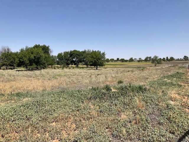
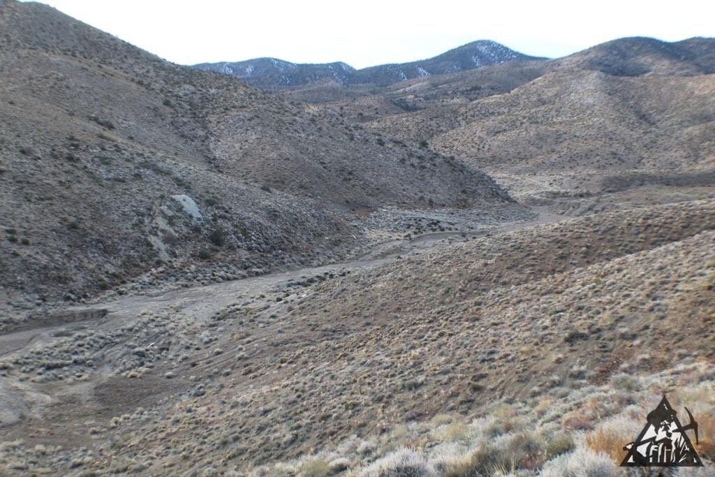
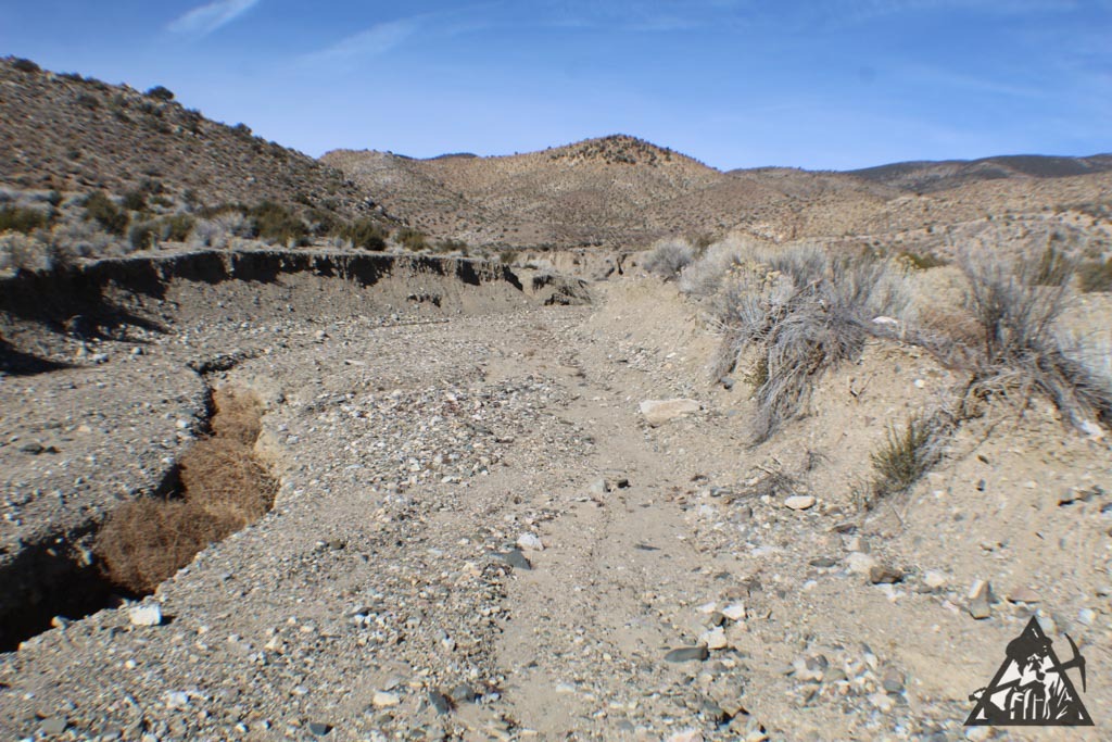
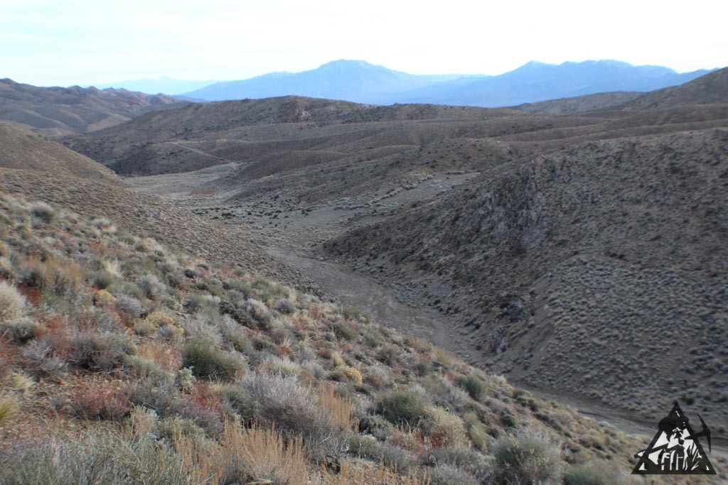
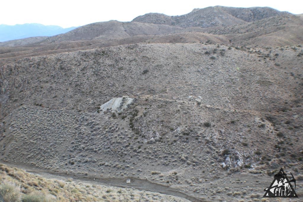
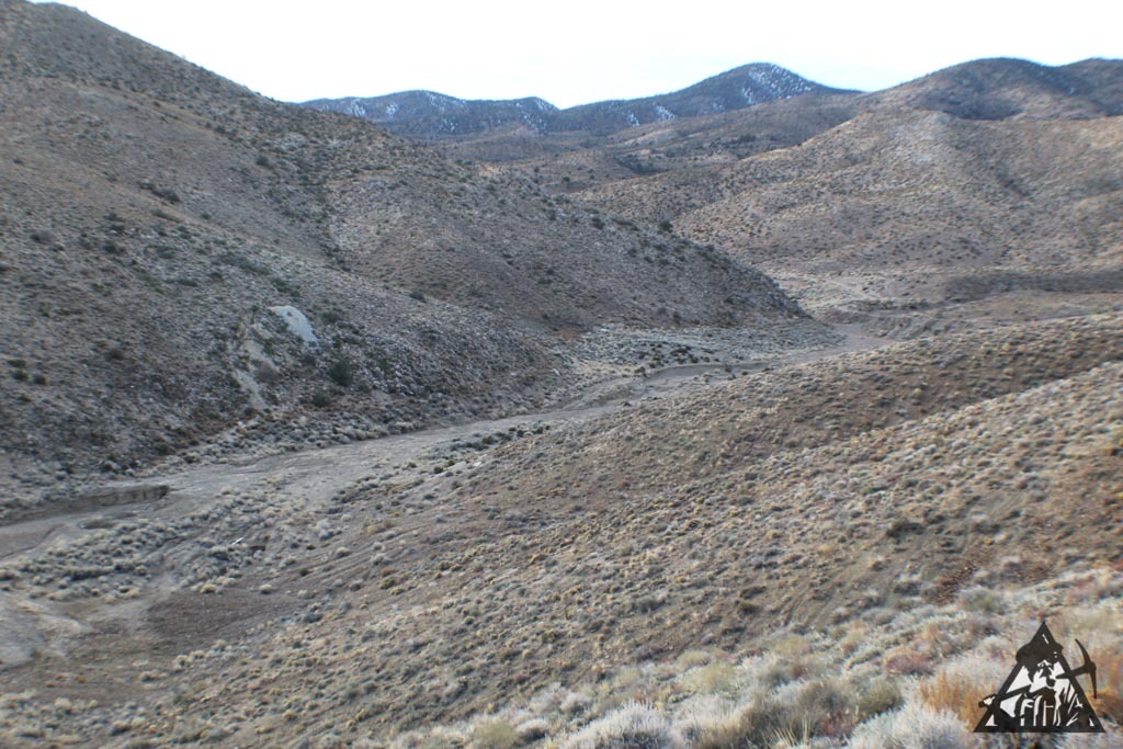
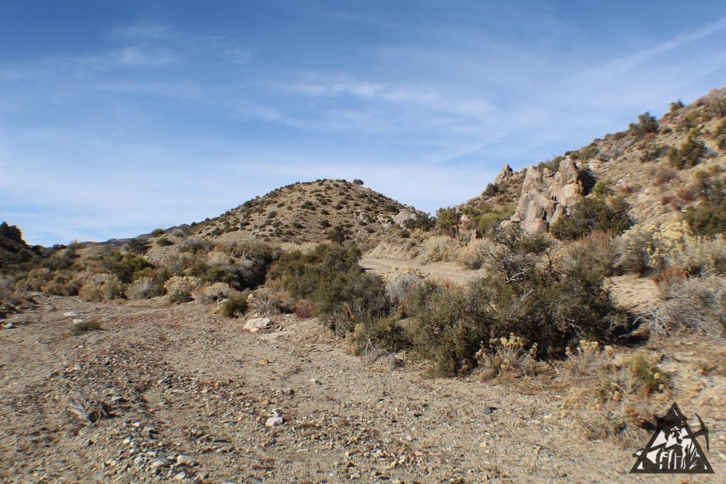
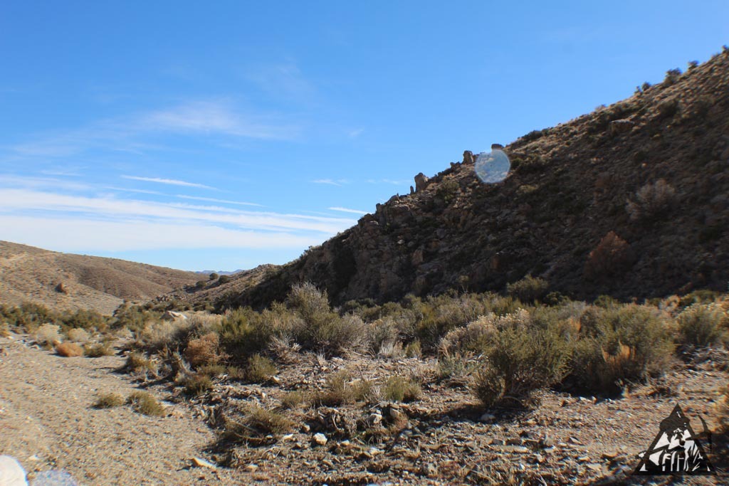
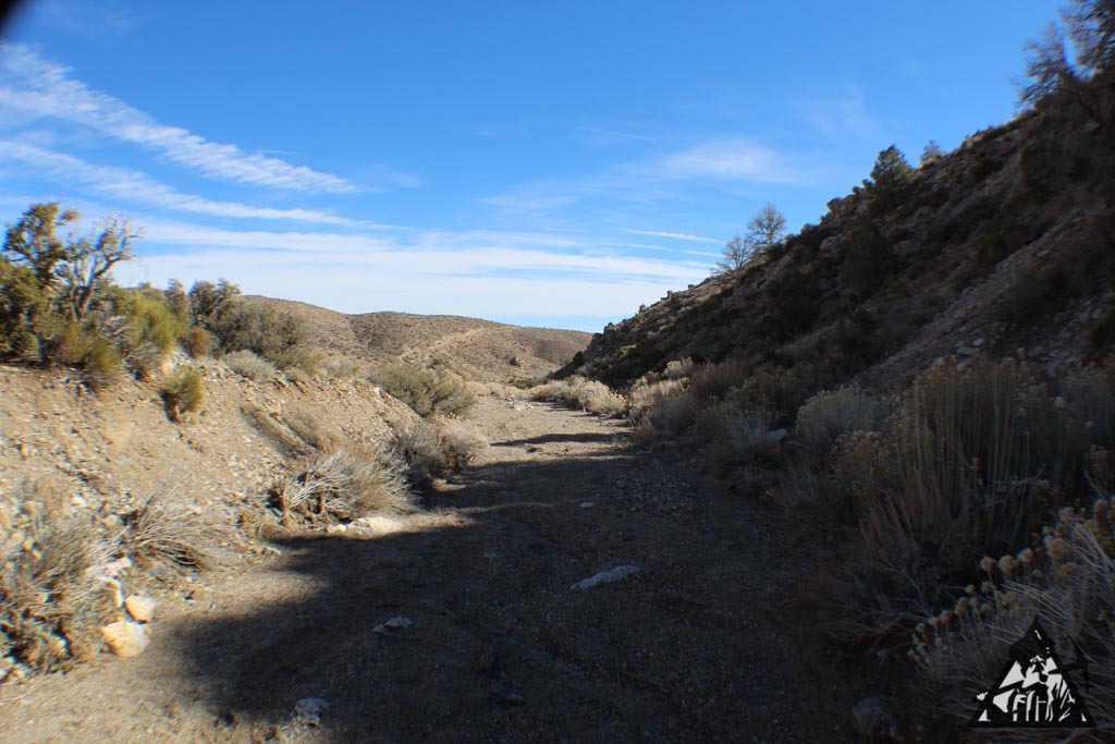
This property is on the west slope of the Humboldt Mountain Range below Indian Peak and close to the point where the gentle slope up from the Humboldt River becomes rough hills. The property has a very nice view of the entire valley and is about 400 feet higher than the Humboldt River.

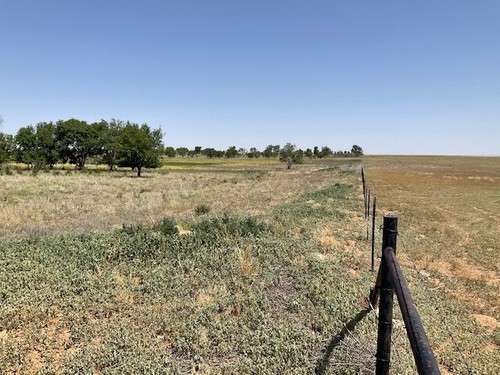
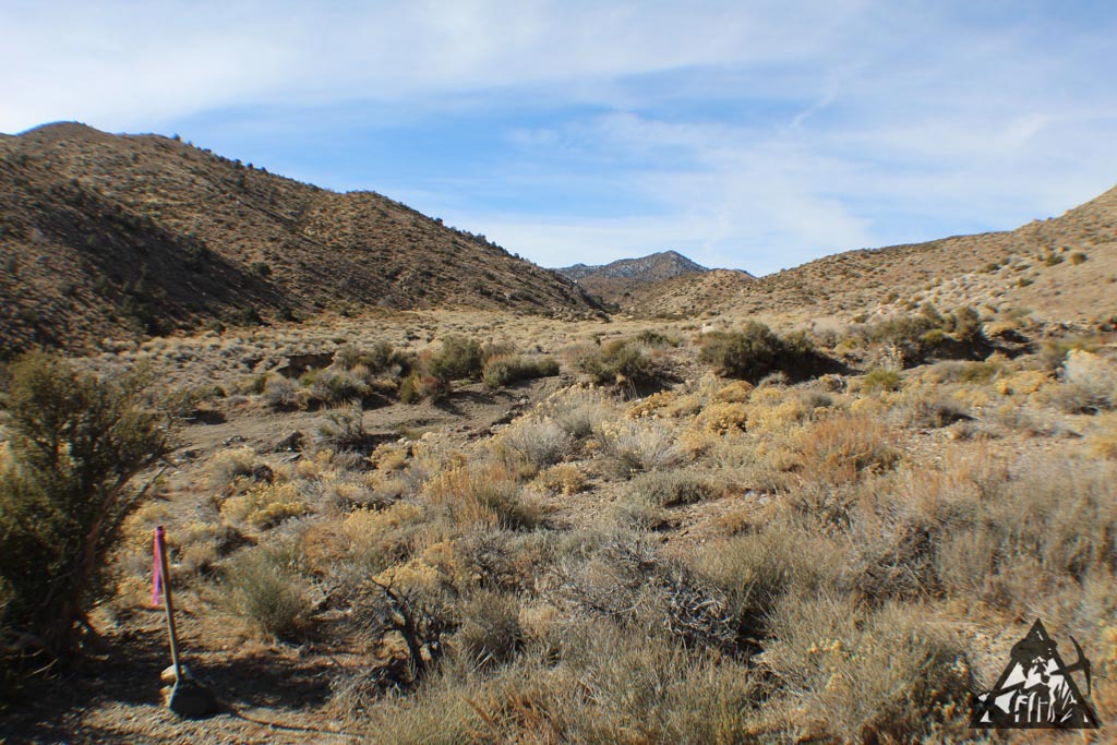
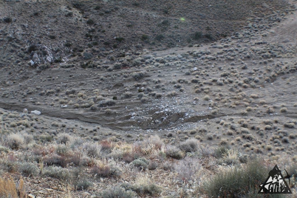
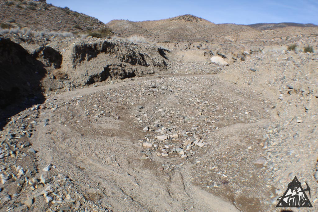
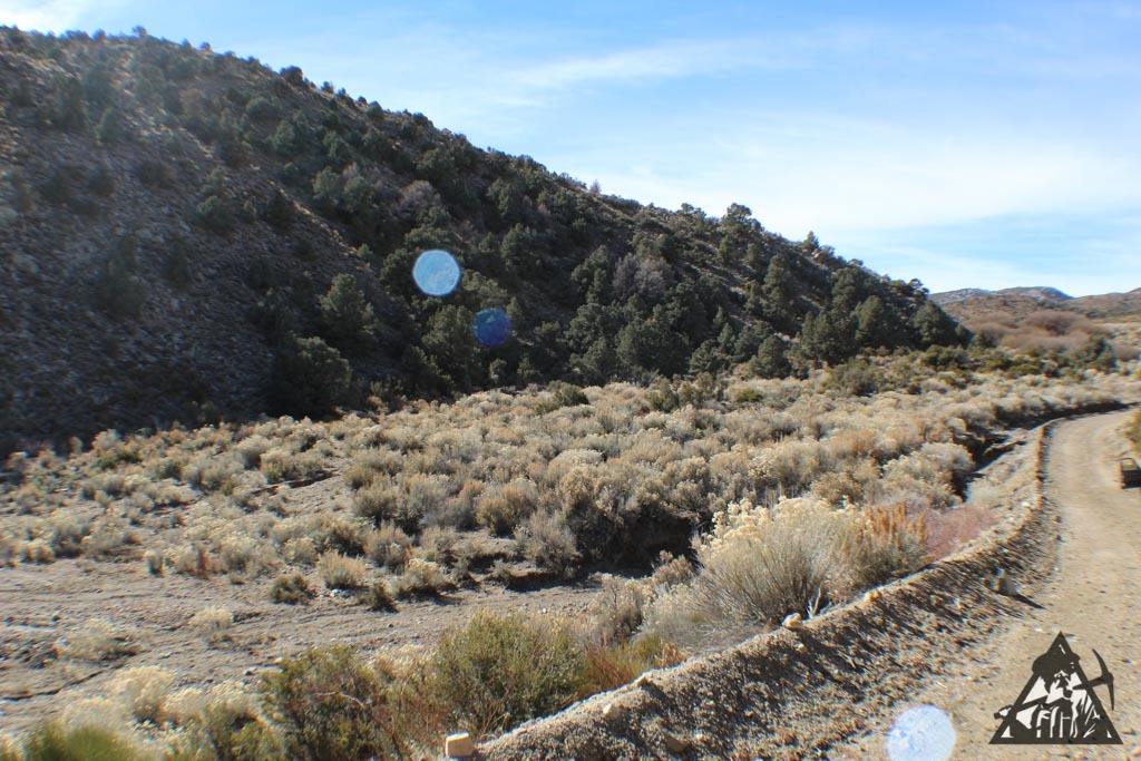
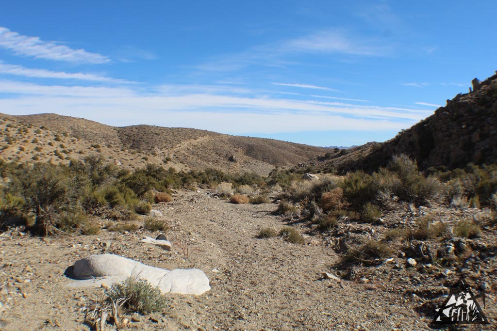
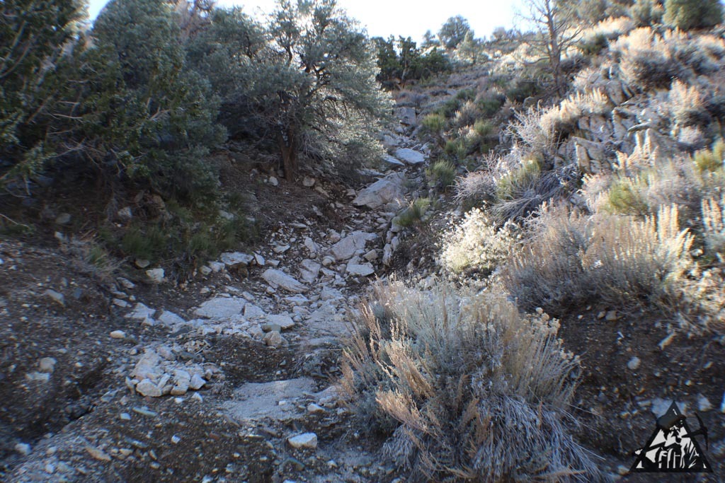
The Property is 15-20 minutes from Lovelock and has a seasonal creek running through it. There are a couple of willow trees near it which tells you that the moisture stays present through the hot, dry summers. The pictures posted with this listing were taken on April 28, 2024, and, as one of the pictures indicates, there was still snow pack in the mountains feeding the stream. Owner’s rough estimation is that in late April the water was running at around 400-450 gallons per minute. It is estimated that the creek will probably run for at least another month or so from when the picture was taken. The seasonal creek is reliable due to the fact that the Humboldt Mountains receive snow every year (Indian Peak: 8,936 feet elevation).

The property is situated at elevations between approximately 4,550 to 4,750 feet above sea level. Based on a review of the well drilling logs for the area, the water table is approximately 150 feet deep. Of course, this is an approximation. You can verify yourself at the Nevada State Water Engineer website. Cost of drilling a well is generally in the range of $80-$110 per foot.

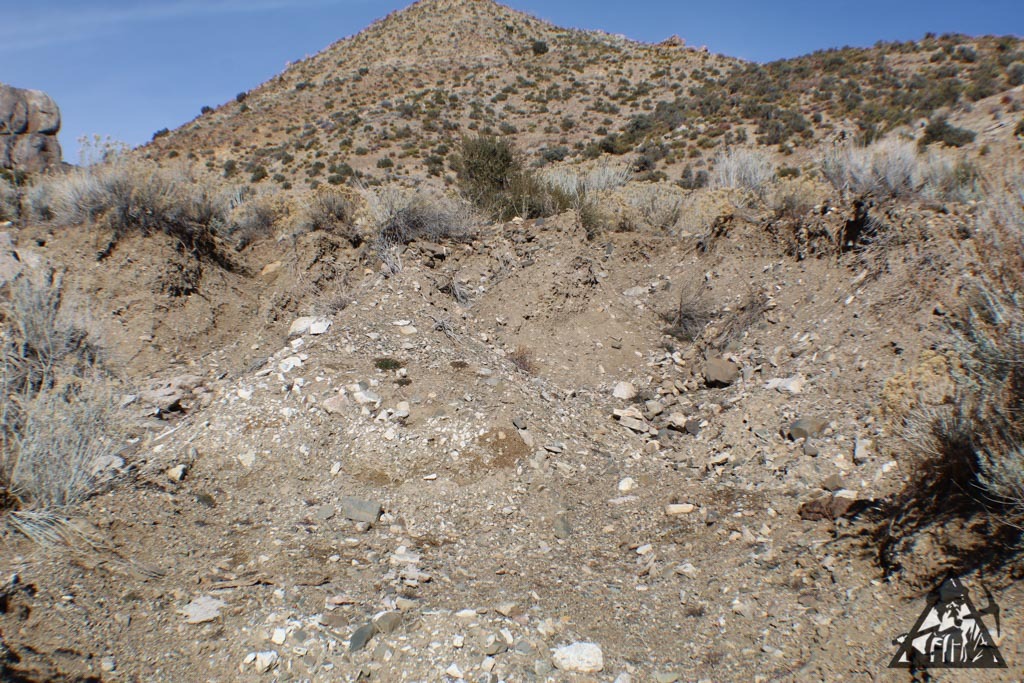
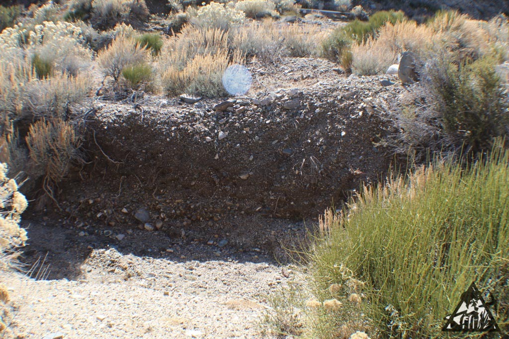
The soil is sandy loam with a bit of clay, therefore the soil has the ability to retain moisture very well especially with proper mulching. This is good if you plan to plant fruit trees, berry bushes, and/or forage crops. There are a number of cold-hardy fruit and nut trees that can tolerate Pershing County winer and summer temperatures.

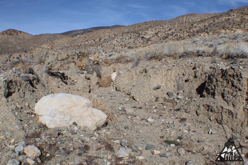
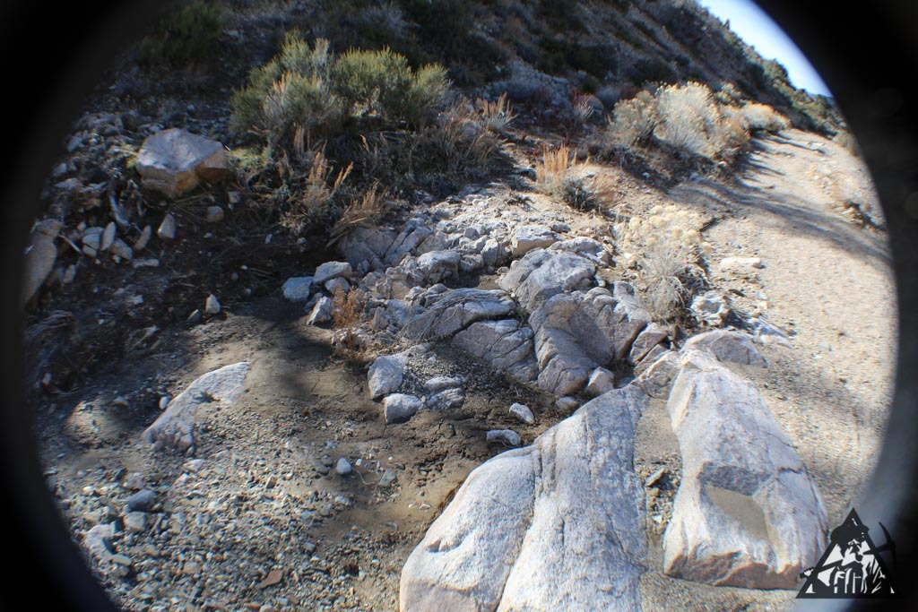
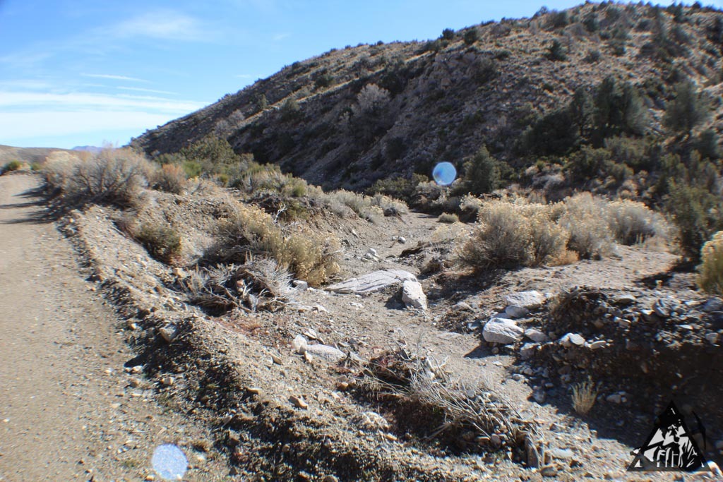
There are also two significant gullies that run down from the hills. An inspection of the gullies suggests that these gullies likely have water running through them on a regular basis during rain events. Water coming off the mountains North East of the parcel generally flows through the North side of the parcel.

The four corners of the property are marked with stakes, but buyer must verify boundaries with a survey. BLM borders the property to the East, and large parcels border the property to the North, West, and South. BLM almost certainly has a record of survey recorded, so any survey you perform has a very good start (i.e., makes your survey less expensive). The Southern boundary has a maintained barbed wire fence, although no livestock was seen on the neighboring parcel and there are no corrals. The picture containing the boundary lines to the property is slightly off. According to personal observations of where the posts are on the property, a more accurate placement of the corners are all about 30-40 feet to the West than is shown on the pictures. Buyer must conduct their own investigation.

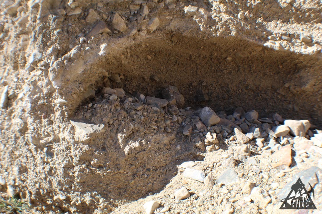
A visit to the property in late April 2024 saw antelope near the property and horse manure and hoof marks were evident around the property indicating wild horses or donkeys frequent the property.

The property is carpeted with grass (a non-bunch grass), mallow, pepperweed, some mustard, primrose, sage, and other flora. While the summer may turn the land dry, there is much life on this property.

County maintained road is about ¾ mile away, which is the start of a seldom used dirt road that comes within one hundred yards or so of the northwest corner of the property. The dirt road is not too rough and probably can be made by car.

The plat map shows a line through the property and an “aqueduct” present. A bit of research indicates that around 100 years ago there was an above-ground pipe that piped the water from Wright Canyon (Wright Canyon Creek) North East of the parcel to someplace to the South. The pipeline was dismantled ages ago and no piping or debris is present.

This listing is by the owner of the property. Please read this entire listing carefully prior to emailing me. There is no time limit to build, no HOA, and the property is zoned AMR. If you do have questions regarding building, you can call the Pershing County Planning or Building Departments. They will have much more pertinent, informative answers to questions than I can give.
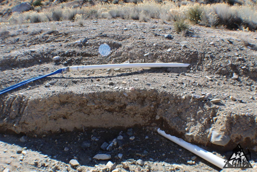
Water: No well

Electrical: Not Connected; Houses along Well Road are connected

Seller will consider financing with a significant initial deposit. Low-ball offers not welcome. This is one of the few properties in Pershing County with a seasonal creek near a town.

Item specifics

Seller Notes
“Vacant Land”
Acreage
40
Seller State of Residence
California
Type
Homesite, Lot
Property Address
T29N R33E Sec. 15 ; APN: 011-130-06
Zip/Postal Code
89419
Zoning
Mixed
City
Reno
State/Province
Nevada
See Map
Portions of this page and links may be provided by third party content providers such as MapQuest.com, and they are solely responsible for such content.

REAL ESTATE LOT ARKANSAS HAMBURG LOT EASY TERMS ! BUY THE AMERICAN DREAM !!!!!!!

REAL ESTATE LOT ARKANSAS HAMBURG LOT EASY TERMS ! BUY THE AMERICAN DREAM !!!!!!!

Price: 1,000.00 USD

REAL ESTATE LOT ARKANSAS HAMBURG LOT EASY TERMS ! BUY THE AMERICAN DREAM !!!!!!!

THE AMERICAN DREAM-TO PURCHASE PROPERTY IN THIS GREAT COUNTRY OF OURS: UNITED STATES OF AMERICA!

—————————————————————————————

—————————SMALL TOWN U.S.A.!————————————–

–ACT NOW–NO BANKS-NO CREDIT CHECK! EASY TERMS!—-

                               ><>THE AMERICAN DREAM!<><

YOU ARE BIDDING ON THE DOWN PAYMENT AND THEN THE MONTHLY PAYMENT OF ONLY $99.00 PER MONTH FOR 15 MONTHS-0 INTEREST-NO PRE-PAYMENT PENALTY. TOTAL PRICE IS ONLY $1,485.00.

OR: PRESS “BUY IT NOW” FOR ONLY $1,000.00.

———————-MY LOSS YOUR GAIN!—————————————

————————————————————A GREAT FAMILY TOWN———————————————————–

COME TO THE ALL AMERICAN TOWN OF HAMBURG ARKANSAS-HOME OF FAMOUS SCOTTY PIPPEN.

BARBECUE-HIKE-HUNT-FISH-CANOE-KAYAK OR JUST SIT BACK AND ENJOY LIFE-THE WAY IT SHOULD BE!

PARCEL#705-01422-000

BLOCK 001

ACREAGE- 0.23  RESIDENT VACANT.

PLEASE DO NOT BID UNLESS YOU ARE PLANNING ON FOLLOWING THRU WITH THE PURCHASE PROCESS.

THANK YOU FOR BIDDING!

UPON ALL PAYMENTS YOU WILL RECIEVE A DEED-FREE AND CLEAR.

Item specifics

Seller Notes
“NEW”
Acreage
0.23
Seller State of Residence
Massachusetts
Type
Homesite, Lot
Property Address
S. HICKORYST.
Zip/Postal Code
71646
Zoning
Residential
City
HAMBURG
State/Province
Arkansas
See Map
Portions of this page and links may be provided by third party content providers such as MapQuest.com, and they are solely responsible for such content.

Treasure Hills Subdivision, Lot 183 Horseshoe Bend, Arkansas

Treasure Hills Subdivision, Lot 183  Horseshoe Bend, Arkansas

Price: 3,250.00 USD

Treasure Hills Subdivision, Lot 183 Horseshoe Bend, Arkansas

Item specifics

Acreage
0.32
Seller State of Residence
Wisconsin
Type
Homesite, Lot
Property Address
210 S Jewel Road
Zip/Postal Code
72512
City
Horseshoe Bend
State/Province
Arkansas
See Map
Portions of this page and links may be provided by third party content providers such as MapQuest.com, and they are solely responsible for such content.

9.1 Acres of Vacant Land Recreational Paradise Near Wikieup Arizona

9.1 Acres of Vacant Land Recreational Paradise Near Wikieup Arizona

Price: 29,800.00 USD

9.1 Acres of Vacant Land Recreational Paradise Near Wikieup Arizona

9.10 Pristine Vacant Mountain Acres with dirt road all the way to property

Satellite virtual video available upon request.

Incredible views, unlimited recreational potential, close to Wikieup, 40 miles from Kingman, 2 hours to Phoenix, Vegas, Grand Canyon, amazing location.

Near Grand Canyon, easy drive to Kingman, Meadview, Vegas. Perfect recreational property for personal glamping, RV camping. Great forest road directly to property.

Primitive dirt road directly to the property. No easement issues.

Great location for a Cabin, Dome, RV Camp. Great horse property, endless recreational possibilities, Mountain Bikes or Motorcycles and Quads. Hiking, climbing, drone flying, rock/mineral hunting.

Follow GPS coordinates to property.

GPS

34.7087151952081

-113.563082815675

Item specifics

Seller Notes
“Pristine view recreational acreage”
Acreage
9.1
Seller State of Residence
Utah
Type
Recreational, Acreage
Property Address
34.7087151952081 -113.563082815675
Zip/Postal Code
85360
Zoning
Residential
City
Kingman AZ
State/Province
Arizona
See Map
Portions of this page and links may be provided by third party content providers such as MapQuest.com, and they are solely responsible for such content.

40 Acres for sale Anton, TX

40 Acres for sale Anton, TX

Price: 400,000.00 USD

40 Acres for sale Anton, TX

40 acres for sale off of Hawaii road. Minutes from Lubbock, TX. Would be the perfect spot for a cattle ranch. Multiple thickets of trees across the land for shade and partially fenced. Property is fully equipped with a well, electric polls, and when it rains water gathers, so there is great potential for a natural pond. Serious buyers only, please. This post is to inform. Will not officially sell over eBay. Need to call if interested in buying the property: 806-620-6490.

Item specifics

Acreage
40
Seller State of Residence
Texas
Type
Recreational, Acreage
Property Address
Hawaii Rd Anton, TX
Zip/Postal Code
79313
Zoning
Residential
City
anton
State/Province
Texas
See Map
Portions of this page and links may be provided by third party content providers such as MapQuest.com, and they are solely responsible for such content.

Lot For sale-NEW ORLEANS LA Historical Lower Niñth ward

Lot For sale-NEW  ORLEANS LA Historical Lower Niñth ward

Price: 20,000.00 USD

Lot For sale-NEW ORLEANS LA Historical Lower Niñth ward

This lot is a great addition to any real estate collection. It is a homesite in the Lower Nineteenth Ward of New Orleans, Louisiana. The property address is on Tennessee Street and the zip/postal code is 70117. The lot is residential zoned and has an acreage of 0.118. The seller state of residence is Louisiana and the city is New Orleans. This item falls under the Land and Real Estate categories.

Item specifics

Seller Notes
“Need to build high on lot”
Acreage
0.11
Seller State of Residence
Louisiana
Type
Homesite, Lot
Property Address
2300 block Tennessee st New Orleans la 70117
Zip/Postal Code
70117
Zoning
Residential
City
New Orleans
State/Province
Louisiana
See Map
Portions of this page and links may be provided by third party content providers such as MapQuest.com, and they are solely responsible for such content.

0.61 Acre Lot in Rio Grande County, CO – Stunning 360° Mountain Views, No HOA

0.61 Acre Lot in Rio Grande County, CO – Stunning 360° Mountain Views, No HOA

Price: 31,000.00 USD

0.61 Acre Lot in Rio Grande County, CO – Stunning 360° Mountain Views, No HOA

Welcome to this serene 0.61-acre lot in the heart of Rio Grande County, Colorado. Nestled in the upper Alpine Village, this property offers a bird’s eye view over the picturesque western side of Alpine Village and boasts stunning 360-degree mountain views. This is an ideal location to build your future home or mountain retreat.

Property Highlights:

  • Size: 0.61 acres
  • Location: Upper Alpine Village, Rio Grande County, Colorado
  • Views: Panoramic 360-degree mountain views
  • Covenants/HOA: None – enjoy the freedom of no covenants or HOA restrictions

Imagine waking up each morning to breathtaking vistas of the surrounding mountains, breathing in the crisp, fresh air, and experiencing the tranquility that comes with being immersed in nature. This property provides the perfect escape from the hustle and bustle of city life, offering peace and privacy.

Whether you are looking to build a vacation cabin, a year-round residence, or simply invest in a piece of Colorado’s stunning landscape, this lot offers endless possibilities. The absence of covenants and HOA means you have the flexibility to create your dream space without restrictive regulations.

Location:

  • Convenience: Accessible location with skiing such as wolf creek and Pagosa Springs
  • Recreation: Close to outdoor activities such as hiking, fishing, and skiing, making it a perfect spot for nature enthusiasts and adventure seekers

Bidder Requirements: We request that buyers with less than 5 feedback contact us before placing a bid. This helps ensure a smooth transaction process and allows us to answer any questions you may have.

Payment Information: In addition to traditional payment methods, we also offer Safe Funds Online Escrow for secure transactions. This service provides an extra layer of protection for both the buyer and the seller. If you prefer to use Safe Funds Online Escrow, please contact us for more details on how to proceed with this payment method.

LEGAL: Selling real estate involves various risks and uncertainties, including but not limited to market fluctuations, zoning changes, and potential liability for property defects. It is important to conduct due diligence and seek the guidance of qualified professionals to mitigate these risks.

The information provided in any real estate listing or advertisement is deemed reliable but not guaranteed. Buyers are encouraged to conduct their own independent investigation and verification of any information provided, including but not limited to property condition, boundaries, and legal and financial considerations.

The seller and their agents make no representation or warranty as to the accuracy or completeness of any information provided, and shall not be liable for any errors, omissions, or inaccuracies. The seller reserves the right to reject any offer or cancel any transaction at any time, for any reason.

This disclaimer applies to all real estate transactions and communications, including but not limited to advertisements, listings, contracts, and disclosures. By engaging in any real estate transaction, you acknowledge that you have read and understand this disclaimer and agree to be bound by its terms.

Item specifics

Seller Notes
“Vacant Land”
Acreage
0.61
Seller State of Residence
Washington
Type
Recreational, Acreage
Zip/Postal Code
81154
City
South Fork
State/Province
Colorado
See Map
Portions of this page and links may be provided by third party content providers such as MapQuest.com, and they are solely responsible for such content.

GOLD PLACER CLAIM – TULE CANYON PLACERS

GOLD PLACER CLAIM – TULE CANYON PLACERS

Price: 19,997.00 USD

GOLD PLACER CLAIM – TULE CANYON PLACERS

The Tule Canyon Placers is a multi-ore, past producing placer mining claim, measuring 160 acres, located in Western Nevada, just outside the famous mining ghost town of Gold Point, NV. Riding the Walker Lane, this spot’s enhanced permeability means high geothermal activity – rich gold territory!

The Tule Canyon area is a highly-sought after mining district known for its incredible amount of placer gold and silver, particularly in Nugget Gulch where these claims lie, trapped in little over a dozen feet of gravels all the way down to bedrock. Though worked for decades in the far past, the miners were never able to fully work the site and only dry-washed the surface. Renewed interest in the area has sent droves of prospectors into the area, with some claiming to find gold as unbelievably high 37.3g/ton of gold and 5,090g/ton of silver just due South of the claim site!

The secret to this claim lies in the previous miners’ inability to obtain the gold through dry-washing alone. Wet-washing and various leeching methods, or chemical solutions like aqua regias, have yet to be performed within the Canyon. Trucking in your own water alone will put you miles ahead of where the others left off.

A decent dirt road exiting the small town of Gold Point, NV will lead you right to the claim. Four-wheel drive is recommended. Amenities can be found in the mining ghost-town of Gold Point, NV just a few miles away or in full service towns nearby like Tonopah and Beatty, NV.

Nearby, you’ll find the still-standing history of the One-Eyed Preacher and his immaculate cabin. Taken care of by local residents, stop by and camp under its roof for a night or two!

The TULE CANYON PLACERS Features:
Type of Claim Unpatented Placer Claim
Size of Claim  160 Acres
Commodities  Gold, Silver
Past Production  Yes.
State, County  Nevada, Esmeralda
Accessibility Good 4×4 Dirt Roads
Deposit Type Gravel, 4-mile spread across the Canyon.
Cell Phone Reception  4GLTE All Networks
Relics  No.

DISCOVERY MARKER / CLAIM LOCATION GPS COORDINATES:

Discovery Marker: 37.363056°, -117.534682°


More photos of the TULE CANYON CLAIM available at

www.MountainManMining.com

Economic Features

 Type of Claim Unpatented Placer Claim
 Size of Claim  160 Acres
 Commodities  Gold, Silver, Thorium, Uranium
Ore Body Information
Placer Size  Upper 4 miles of Tule Canyon
Host Rock Gravels
Last Development Ceased in 1936.
District Name Tule Canyon
Known Ores:
Useful:  Columbite, fluorite, monazite, rutile, uranium, zircon
Rare:  Euxenite, xenotime
How to Purchase This Claim

An unpatented mining claim gives the holder the right to mine mineral-rich land that belongs to the federal government. It is a tangible asset that shows proof of all interests in minerals in the area. They can be bought, sold or used as collateral, just like any other piece of real estate.  Mining claims have been bought and sold for 150+ years.

When you buy a claim MountainManMining.com will issue a quit-claim deed to the according county.  The deed conveys all mineral rights, and interests to you.  A copy of the deed is also issued to the Bureau of Land Management for recording.  The transfer process typically is completed by all parties, and the official paperwork returned to you within 10-14 days after purchase.

When you decide on this claim we take care of the full mineral rights transfer on your behalf.  All filing and transfer fees are included in the price listed below.  Yearly assessments are paid up through 9/1/2023.   It’s just $10 per year to maintain your claim with the BLM with a small miners exemption.  Full info on maintaining your claim can be found here.

  • TULE CANYON PLACERS 160 Acres Lode Mining Claim
  • Official Certificate of Location & Maps of Location
  • Full Claim Transfer Guaranteed Within 14 Days

  • Anytime Support for Filing and Claim Maintenance Questions

More Information:  Please send me an eBay message with questions about

purchasing this claim. 

You can also visit our parent website: https://mountainmanmining.com for

more claims, photographs, aerial photography, frequently asked questions

and more.  

Item specifics

Acreage
160
Seller State of Residence
Nevada
Type
Mining Claim
Zoning
Unpatented Placer Mining Claim
City
Reno
State/Province
Nevada

0.41 Acre Wooded Lot on Hilltop in NW Missouri Lake Viking Kansas City Gallatin

0.41 Acre Wooded Lot on Hilltop in NW Missouri Lake Viking Kansas City Gallatin

Price: 4,499.00 USD

0.41 Acre Wooded Lot on Hilltop in NW Missouri Lake Viking Kansas City Gallatin

This 0.41-acre wooded lot is located on a hilltop in Lake Viking, Missouri. The lot is zoned for residential use and is perfect for building a dream home, weekend getaway retreat, or simply a spot to park your RV or place a storage shed to enjoy the Lake Viking amenities. The property address is Lot 2136, on Barracuda in Lake Viking which is about 60 minutes north of Kansas City. The area is surrounded by lush natural woods and has a peaceful atmosphere that provides a tranquil environment for a home. This lot is an excellent opportunity for anyone looking to build or relax in NW Missouri. Don’t miss out on this chance to own a beautiful piece of land in a prime location!

For buyers unfamiliar with the area, Lake Viking is near Gallatin, Missouri. 

The title to this property is free and clear, with no encumbrances. Fast and easy closing. 

Short-term seller financing for up to six months is available with 20% down payment. Transfer of title made upon receipt of payment in full. 


Item specifics

Seller Notes
“Excellent”
Acreage
0.4
Seller State of Residence
Missouri
Type
Homesite, Lot
Property Address
Lot 2684, Lake Viking Terrace, Lake Viking, Missouri
Zip/Postal Code
64640
Zoning
Residential
City
Kansas City
State/Province
Missouri
See Map
Portions of this page and links may be provided by third party content providers such as MapQuest.com, and they are solely responsible for such content.

Agricultural plot Kettleman City, Ca. Kings COUNTY

Agricultural plot Kettleman City, Ca. Kings COUNTY

Price: 1,014.00 USD

Agricultural plot Kettleman City, Ca. Kings COUNTY

     King of Agriculture

Kettleman City, Ca.

Kings COUNTY

NO MINIMUM / NO RESERVE      —        HIGH BID OWNS THE LOT

This agricultural Land is in the vicinity of Kettleman City; is a census-designated place in Kings County, Ca. Kettleman City is located 28 miles southwest of Hanford, 54 miles south of Fresno, at an elevation of 253 feet, and sits only about 1/2-mile North of the 36th parallel north latitude. It is part of the Hanford–Corcoran Metropolitan Statistical Area. The population was 1,439 at the 2010 census, down from 1,499 at the 2000 census. Kettleman City is near the halfway point between Los Angeles and San Francisco or Sacramento on Interstate 5 at Exit 309, and thus is a major stopping point for food and lodging. Kettleman City is located on the west side of the San Joaquin Valley at the base of the Kettleman Hills, near the historic shoreline of what used to be Tulare Lake.  There is considerable service commercial development at the Interstate 5/State Route 41 junction to meet the needs of highway travelers.

Many local residents are employed in agriculture, which experienced significant growth on the west side of the San Joaquin Valley after the completion of the California Aqueduct in the early 1970s.

Attached is the Kings County Assessors Map of the Lot as well as some maps of the area and some pictures.

The property will be conveyed by a California Grant Deed which is the most commonly used deed in California.

Values are on the rise!

 Don’t miss out on this one!

We are going to start the bidding at just $780 on this beautiful property and there will be NO RESERVE. In other words, we will sell the property regardless of what the final bid amount is. There is a small $395 doc fee in addition to the winning bid price, which offsets the cost of the listing and other fees.

The property is being sold “As-is, Where-is” and any potential bidder should perform their own due-diligence. All information was obtained through sources deemed reliable, but we cannot guarantee the accuracy thereof.

DON’T MISS OUT ON THIS GREAT OPPORTUNITY!!

Property Profile:

Property Address: Kettleman City, CA 93239

APN: 038-156-011-000

Legal Descripcion: LOTS 85, 86 & 87 KETTLEMAN CITY SUB #5 B

Use Type: Agricultural

Lot Size: 5,375 sq. ft.

HOA: NO HOA fees.

State/Province:  California

Taxes: Only $1 per Year

Zoning: AG40

County: Kings  

Deed: Grant Deed

City/ Location: Kettleman City, CA 93239   See Map.

Bid and buy with confidence.

The photos 2, 4, 6, 8, 10 and 12 show the actual property and the surrounding lots. Photos 1, 3, 5, 7, 9, and 11 shows general area.

We have also included a County Parcel Map and an aerial Map to help you. The assessor’s parcel number to the property is Kings County APN # 038-156-011-000

Here is a link (including the GPS coordinates) to view the location of the property on Google Maps:

36.030021,-119.980906

(You may have to copy and paste this to use it.) Once the map pops up, simply use the zoom tool on the left side of that screen to view the map in more detail. You can even view an aerial photo by clicking on the Satellite tab in the upper right portion of that screen.

The winning bidder must contact us within 24 hours of the closing of this property and submit payment within 48 hours. We accept the following forms of payment: Personal check, Cashier’s Check, U.S. Postal Money Order, and Bank Wire Transfer. All bidders with 0 feedback should contact us prior to making a bid.

The property is being sold “As-is”, “Where-is” and any potential bidder should perform their own due-diligence. The Purchaser (Bidder) in its sole discretion being satisfied that the property is suitable for the Purchaser’s (Bidder) intended uses, following; the Purchaser carrying out due diligence investigations on the overall viability of the property and including but not limited to searching any and all easements; property back tax if any, utilities, water and mineral rights, road access, etc.  and any requirements of the local authority; This clause is for the sole benefit of the Purchaser (Bidder). All information for this property was obtained through sources deemed reliable but we cannot guarantee the accuracy thereof. The high bidder will be considered the winning bidder (purchaser) and the sale will be considered binding!

Good Luck,

Happy Bidding!

Item specifics

Seller State of Residence
California
State/Province
California