Fassi F200BS.23 Knuckle Boom Crane

Fassi F200BS.23 Knuckle Boom Crane

Price: 6,000.00 USD

Fassi F200BS.23 Knuckle Boom Crane

Fassi F200BS.23 Knuckle Boom Crane – Selling as is – Unable to test and that is the only reason I’m listing for parts.  It may be fully functional and ready to work but because I can’t test it, I don’t want to list it as used.  

This crane was removed from a working Freightliner M2 however we have not tested the crane as it has to have hydraulics attached to test it and we don’t have the ability to do that.  This is a medium duty crane and is suitable for two and three axle trucks. 

If you are close to Whitesville, KY I would encourage you to come look at the crane prior to bidding.  

Buyer is responsible for shipping which would likely need to be transported by hauler as it does take up a full 26 foot flatbed.   

Call Ike at Owensboro Truck Sales – 2703167057

If you need parts for trucks or heavy equipment and don’t see what your looking for in our listings please give us a call.

50 Years of Truck Parts Experience!

Thanks for Looking and Have a Great Day!

Item specifics

Condition
For parts or not working

An item that does not function as intended and is not fully operational. This includes items that are defective in ways that render them difficult to use, items that require service or repair, or items missing essential components. See the seller’s listing for full details. See all condition definitionsopens in a new window or tab

Seller Notes
“Listing this “for parts or not working” cause we can’t test it and offer no guarantee of …
Model
F200BS.23
Make
Fassi
Equipment Type
Knuckleboom Loader

Palfinger PK15500

Palfinger PK15500

Price: 17,500.00 USD

Palfinger PK15500

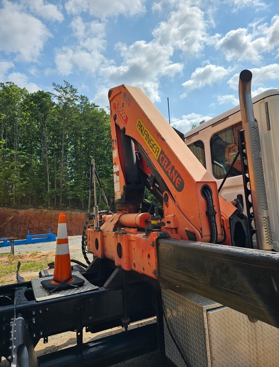
Working Palfinger 15500 knuckle boom crane. Comes with outriggers, remote and tank. It came off of a truck so it did not include the pto (which stayed on the truck). Pick up or freight arranged by buyer. Additional $200 loading fee. Please book a flat bed trailer. This will not fit in a box truck. Video available. https://rumble.com/v47dtpl-palfinger-pk-15500.html

Item specifics

Condition
Used

An item that has been used previously. The item may have some signs of cosmetic wear, but is fully operational and functions as intended. This item may be a floor model or store return that has been used. See the seller’s listing for full details and description of any imperfections. See all condition definitionsopens in a new window or tab

Seller Notes
“In working order”
Model Year
2007
Model
PK15500
Make
Palfinger
Country/Region of Manufacture
United States
Equipment Type
Knuckleboom Loader

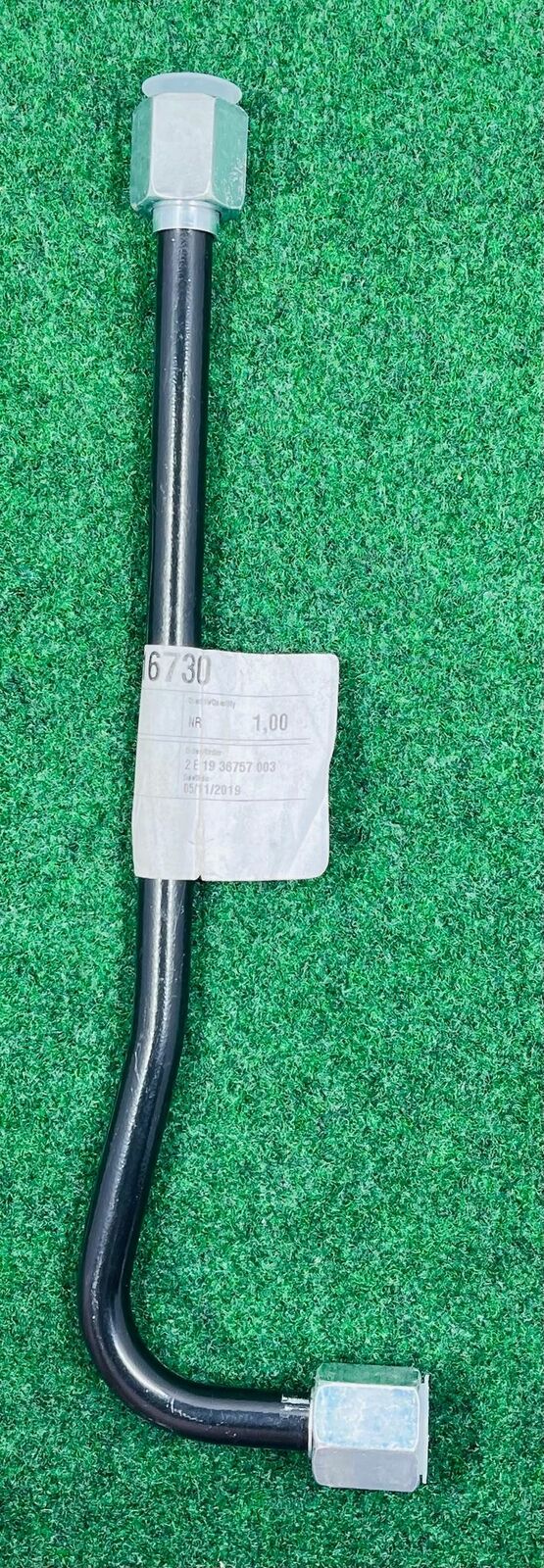
✅ Fassi Pipe/Tubo Crane Attachment – Model 116730 (Fits Various Fassi Cranes

✅ Fassi Pipe/Tubo Crane Attachment – Model 116730 (Fits Various Fassi Cranes

Price: 90.99 USD

✅ Fassi Pipe/Tubo Crane Attachment – Model 116730 (Fits Various Fassi Cranes

Enhance Your Lifting Capabilities! Fassi Pipe/Tubo Crane Attachment – Model 116730 (Fits Various Fassi Cranes)

Expand your Fassi crane’s functionality with this specialized Pipe/Tubo Crane Attachment (Model 116730)!

This attachment is designed for:

  • Efficient and secure lifting of pipes, tubes, and other elongated materials.
  • Streamlining operations in construction, oil & gas, and other industries that handle pipes and tubes.
  • (Optional: Add specific industries where this attachment might be useful based on your research)

Here’s why the Fassi Pipe/Tubo Crane Attachment (Model 116730) is a valuable addition to your equipment:

  • Increased Versatility: Expands your crane’s capabilities for handling specific materials.
  • Enhanced Efficiency: Streamlines pipe and tube lifting operations, saving time and resources.
  • Fassi Quality and Performance: Engineered to meet the high standards of Fassi cranes, ensuring durability and reliable performance.
  • Compatibility: This attachment may fit various Fassi crane models (Please check compatibility with your specific crane model before purchase).

Considering the following before purchasing:

  • Refer to your Fassi crane’s manual or consult a qualified technician to confirm compatibility (model number, lifting capacity).
  • (Optional: Mention any installation requirements if known)

Invest in the Fassi Pipe/Tubo Crane Attachment (Model 116730) and experience the benefits of increased lifting versatility and efficiency!

Fassi Crane Attachment, Pipe/Tubo, Model 116730, Increased Versatility, Enhanced Efficiency, Lifting Pipes, Lifting Tubes, Construction, Oil & Gas (and other relevant industries), Fassi Quality, Performance, Compatibility (Check Your Model).

HANDLING & SHIPPING TIME:

Our Location time zone is Eastern Standard Time (EST) in the United States of America.

Our Handling/Shipping time is Monday thru Friday from 8:00 am to 5:00 pm.

We normally ship items/packages within 1 days.

(IE: You ordered on Monday, we handled it on Tuesday, then shipped on Tuesday = 1 day)

If payment is received on Saturday/Sunday will not be handled until Monday.

Saturday, Sunday, and Holiday are NOT handling/shipping days

RETURN POLICY:

This item is a FINAL sale and there will be NO returns accepted.

Please contact us if you have ANY questions or concerns before purchasing or bidding.

THANK YOU!

WE DO OUR BEST TO DELIVER 5 STAR SERVICE, WITH POSITIVE FEEDBACKS.  

PLEASE if any questions feel free to email me.

  Thanks for looking, HAVE A GREAT DAY.

Item specifics

Condition
New: A brand-new, unused, unopened, undamaged item in its original packaging (where packaging is …

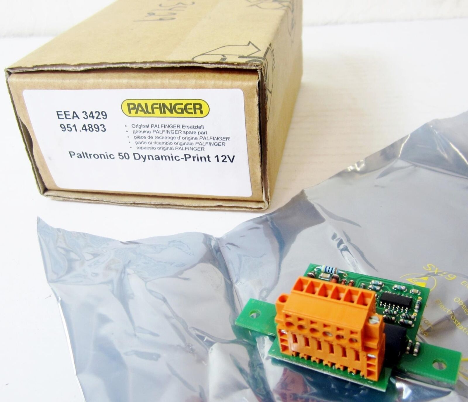
PALFINGER EEA3429 PLATINE ATTACHMENT BOARD, FOR HYDRAULIC CRANE – NEW

PALFINGER EEA3429 PLATINE ATTACHMENT BOARD, FOR HYDRAULIC CRANE – NEW

Price: 126.65 USD

PALFINGER EEA3429 PLATINE ATTACHMENT BOARD, FOR HYDRAULIC CRANE – NEW

Disclaimer

The item offered here is in no way recommended or certified for any specific use. By purchasing this item you agree that the seller shall not be held responsible or liable for any injuries or damages, whether incidental or consequential, associated in any way with this item. By purchasing or bidding on this equipment you are indicating your acknowledgement of and agreement to the terms of this disclaimer.

Shipping & Delivery

Standard shipping is our default shipping method. Under this option we generally use either (FedEx Ground) or (USPS) to ship your package. All shipping charges are calculated by FedEx or USPS and will be displayed at time of checkout. Purchaser is responsible for all shipping, import and brokerage fees assessed by your country’s customs center. Please note: Offer for free standard shipping is only valid in the continental United States (Excludes Alaska, Hawaii, Puerto Rico, Guam, Virgin Islands).

Express Shipments we prefer to be notified by noon, but we can generally process them until 3:00pm (Arizona Time). After 4PM is often possible – but will carry an additional fee of $75.00 (as we have to deliver the parcel to a local terminal). We’re happy to receive your order and will do whatever is necessary to get your order processed immediately.

Freight Shipments If your order is over 150 pounds, or we deem it necessary to keep your order safe (in example, heavier refrigeration equipment), your order will ship on a pallet, using R&L Carriers, FedEx Freight, etc. We can also handle truckloads and partial shipments of heavier machinery.

International Shipping We offer swift, economical shipping via USPS, DHL and FedEx. Please contact us if you would like an international shipping quote. Unless otherwise negotiated, international customers are always required to pay all applicable taxes, duties, and fees. USPS, UPS and FedEx generally bills these charges prior to delivery.

Payment Policy

We accept (Visa, MasterCard, American Express and Discover) and Paypal the secure online payment portal

We can also process other payment methods by contacting through our online contact page.

Return Policy

Products may only be returned if defective. If you have any issues with your item, we must be notified within 14 days of delivery.

If you need anything beyond that, let us know and we will try to work something out. since we rarely find issues with our equipment, problems are handled on an issue-to-issue basis.

We work with our customers to take care of exchanges, repairs, returns, etc.

Before purchasing, please check into the equipment and examine the photos to ensure this is exactly what you want. If available, we supply a manufacturer’s description and specifications.

Otherwise, only the information listed on the item itself is carried over to the description. Again, if something is not pictured, it is not included.

If an item needs to be returned (for any reason), we do not refund the cost of “return” shipping and handling.

If you have any questions, please be sure to contact us before the sale

Item specifics

Condition
New – Open box

An item in excellent, new condition with no functional defects. The item may be missing original packaging and may have been used for testing or demo purposes. The item includes accessories found with the original product and may include a warranty. See the seller’s listing for full details and description. See all condition definitionsopens in a new window or tab

Seller Notes
“This is brand new, in it’s original packaging. It is exactly as pictured. We will include a 14-day …
Kellan Inc SKU #
1000005324
Brand
Palfinger
Model
EEA3429
MPN
EEA3429
Kellan Inc Warehouse Location
S408-33

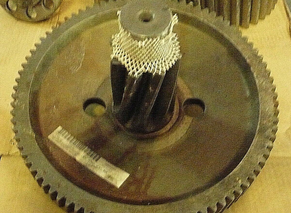
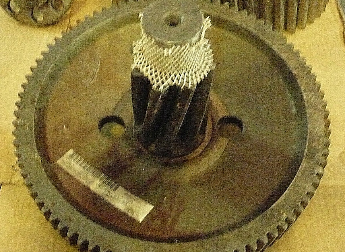
LETOURNEAU CRANE PRIMARY GEAR 0559810

LETOURNEAU  CRANE PRIMARY GEAR 0559810

Price: 2,100.00 USD

LETOURNEAU CRANE PRIMARY GEAR 0559810

 LETOURNEAU  CRANE PRIMARY GEAR 0559810

Item specifics

Condition
New – Open box

An item in excellent, new condition with no functional defects. The item may be missing original packaging and may have been used for testing or demo purposes. The item includes accessories found with the original product and may include a warranty. See the seller’s listing for full details and description. See all condition definitionsopens in a new window or tab

Seller Notes
“NEVER USED. GREAT CONDITION.”
Model
LETOURNEAU CRANE PRIMARY GEAR 055980
MPN
Does Not Apply

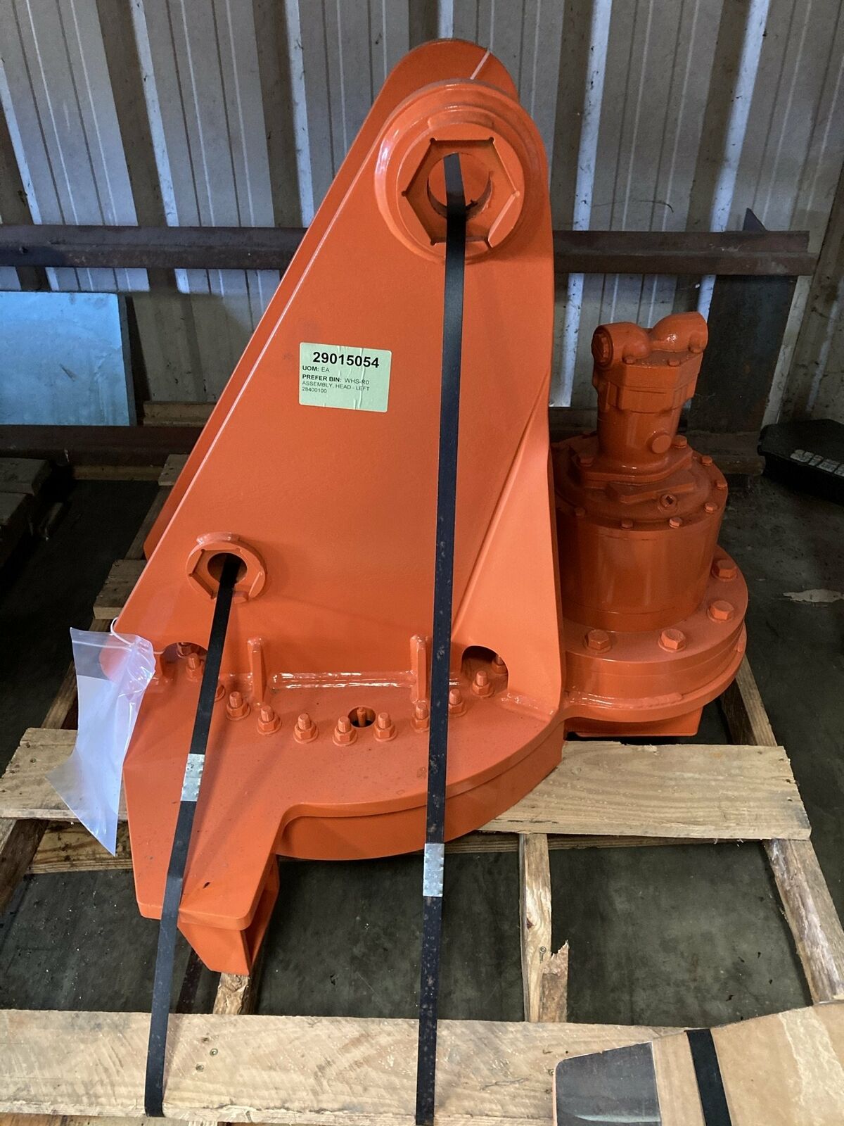
Builtrite LEFT- ASSEMBLY HEAD

Builtrite LEFT- ASSEMBLY HEAD

Price: 7,124.04 USD

Builtrite LEFT- ASSEMBLY HEAD

LEFT- ASSEMBLY HEAD 

CUSTOM MANUFACTURER Builtrite

PART #28400100

Item specifics

Condition
New: A brand-new, unused, unopened, undamaged item in its original packaging (where packaging is …
Model Year
2014
Make
builtrite
MPN
28400100
Country/Region of Manufacture
United States
Equipment Type
Deck Crane

Nevada Gold Silver Gem Mine Lode Mining Claim Shaft Au Ag Beatty NV

Nevada Gold Silver Gem Mine Lode Mining Claim Shaft Au Ag Beatty NV

Price: 7,050.00 USD

Nevada Gold Silver Gem Mine Lode Mining Claim Shaft Au Ag Beatty NV

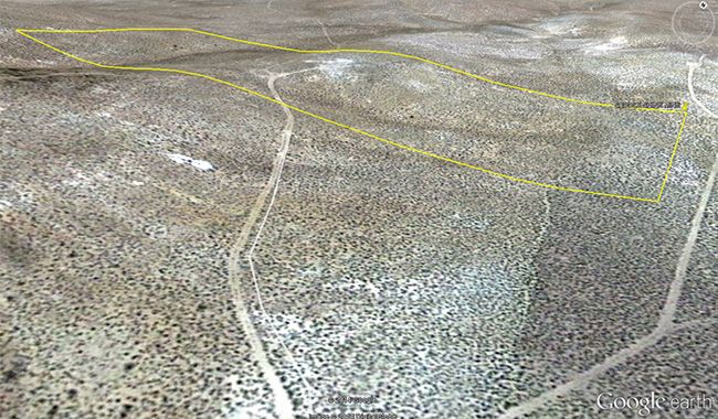
20.66 Acre Unpatented Lode Mining Claim on Federal Land in the Historic Beatty Mountain Nevada Mining District / Nye County Nevada
Pana of Site

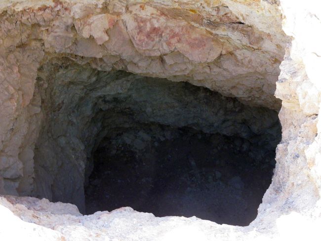
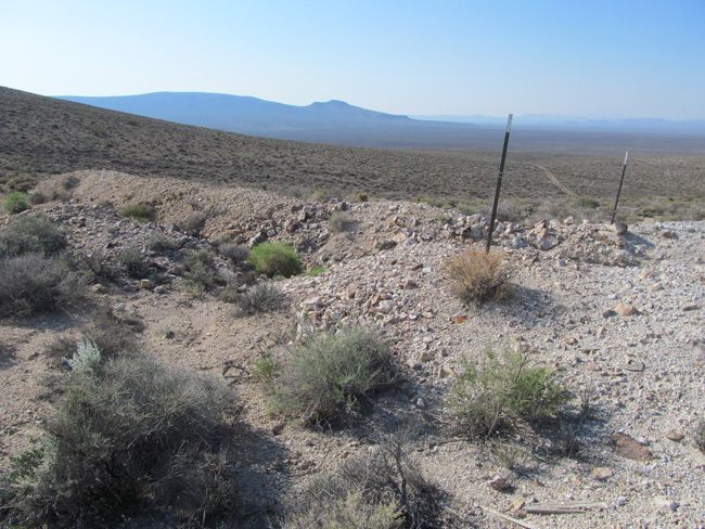
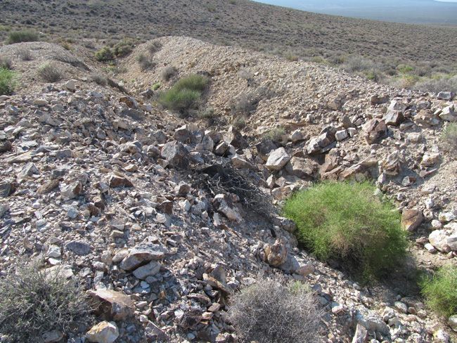
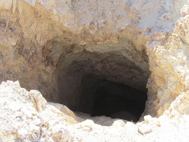
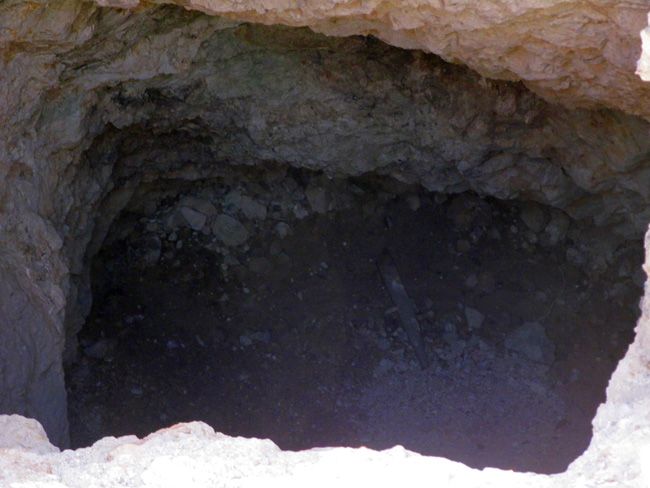
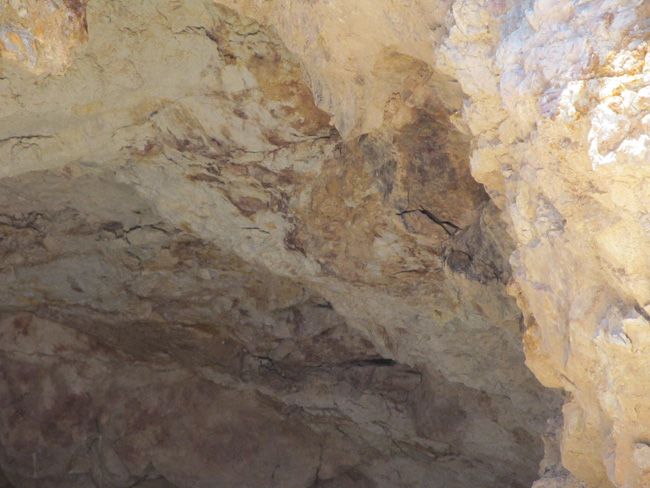
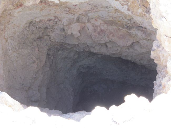
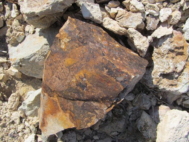
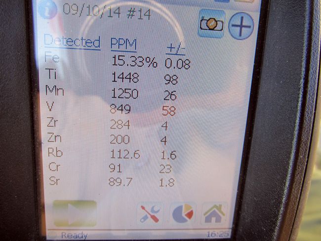
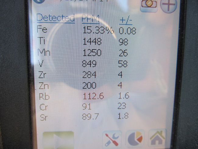
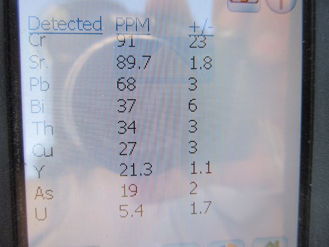
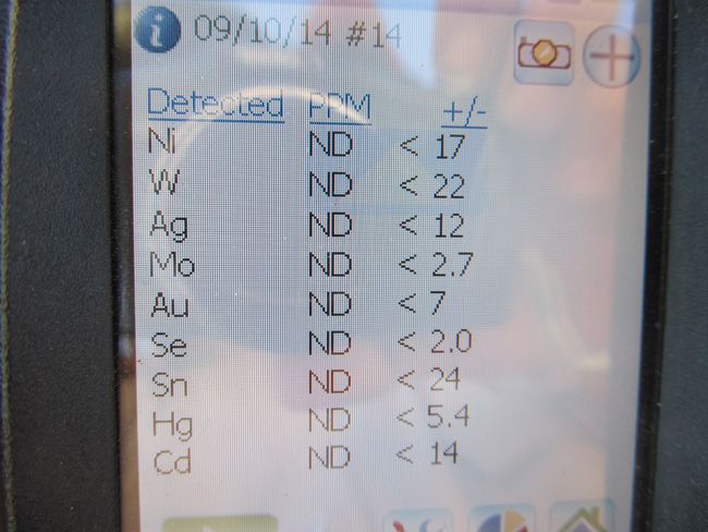
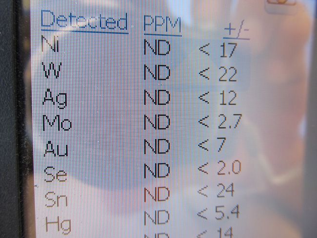
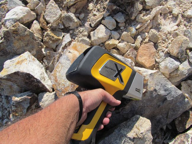
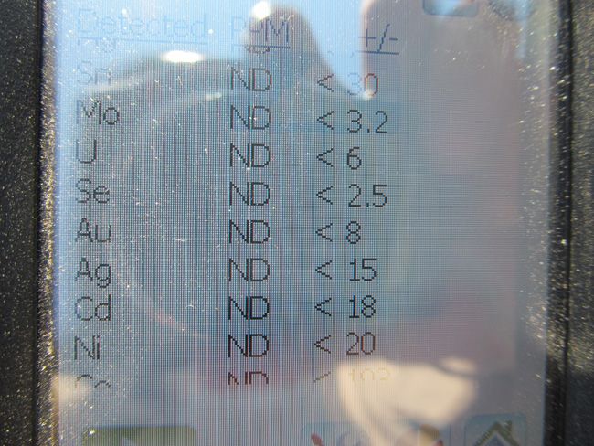
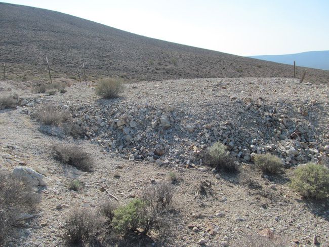
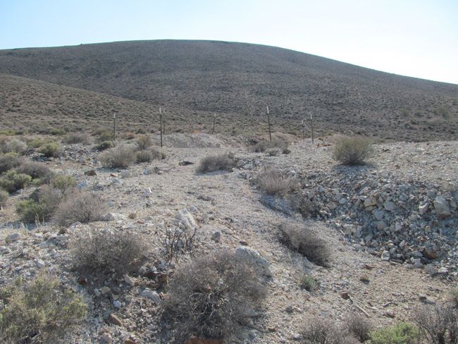
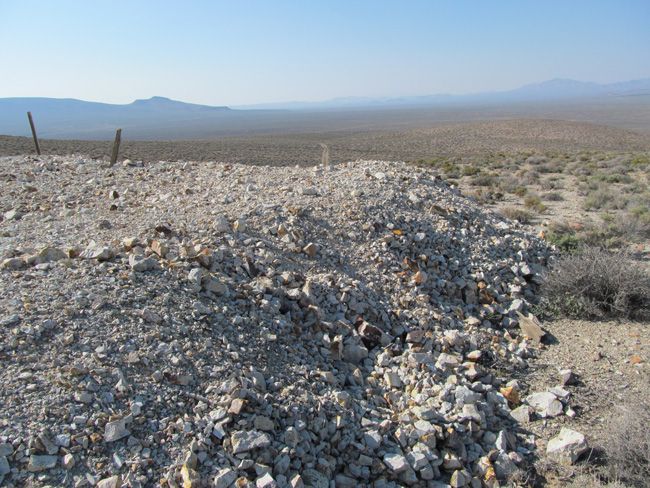
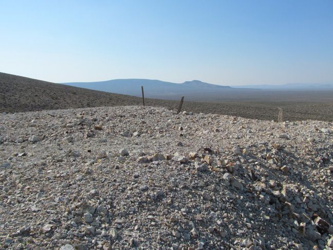
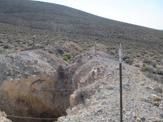
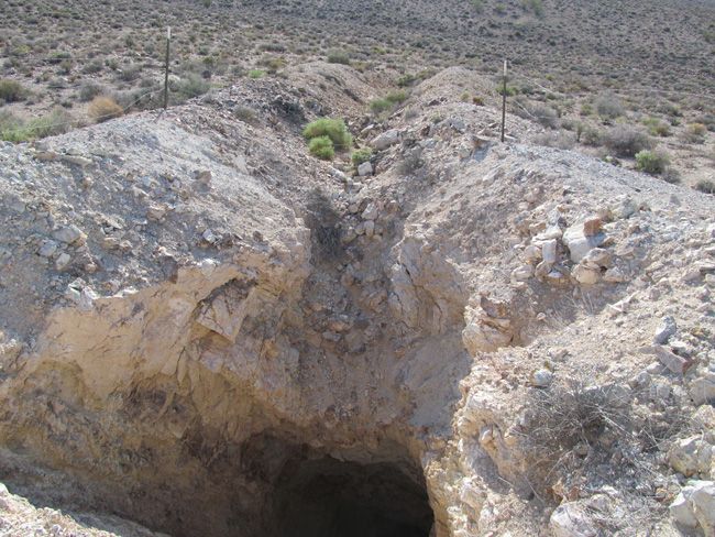
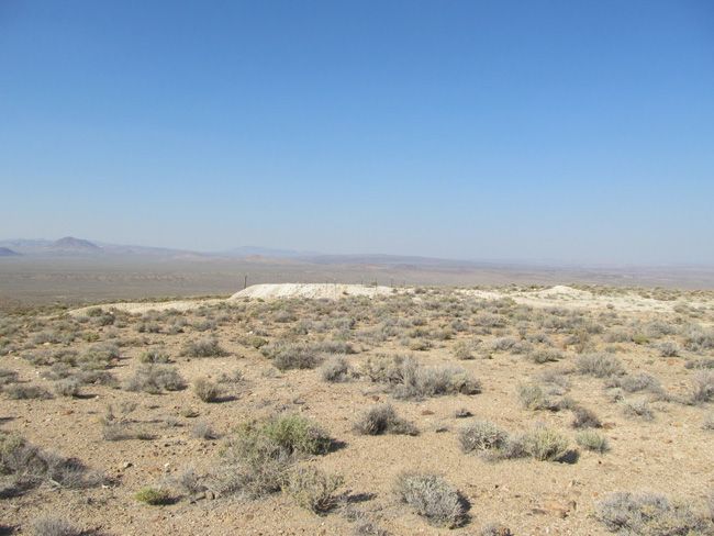
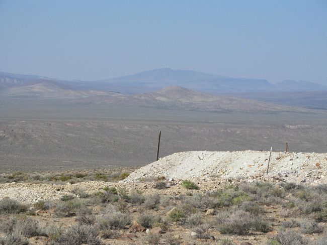
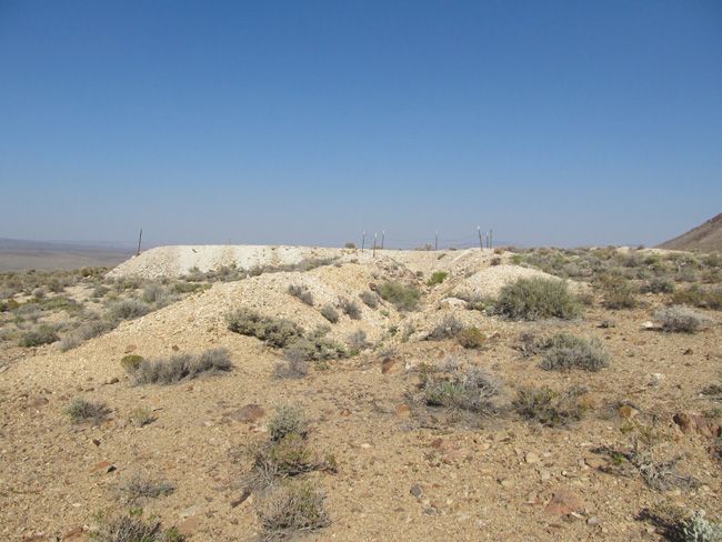
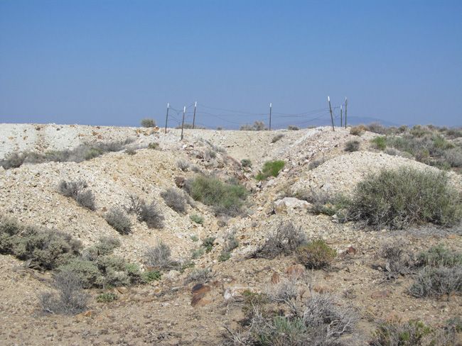
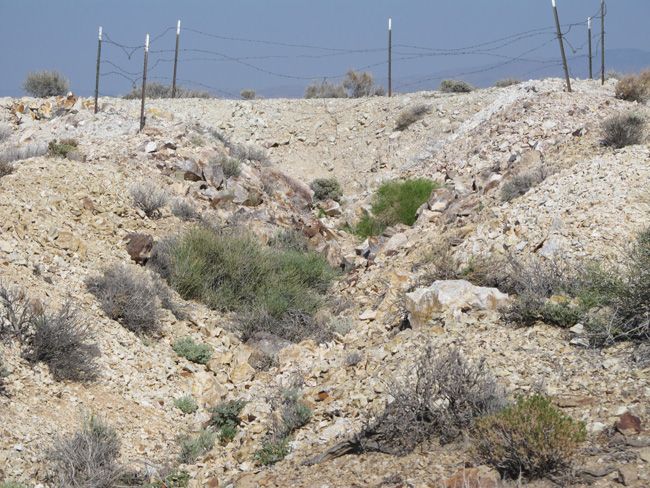
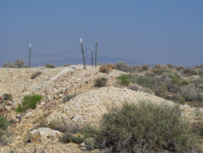
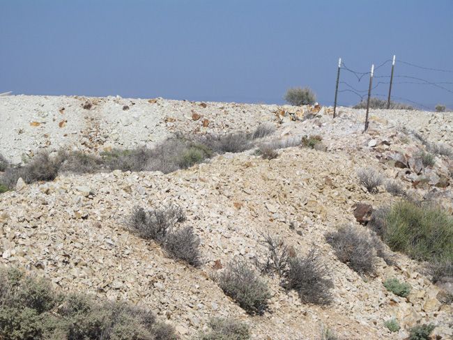
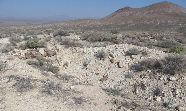
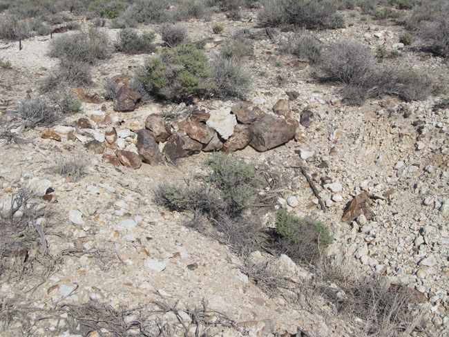
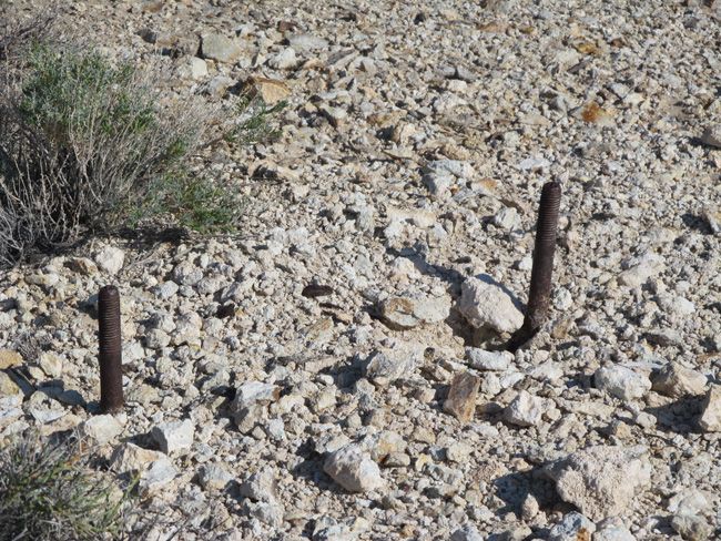
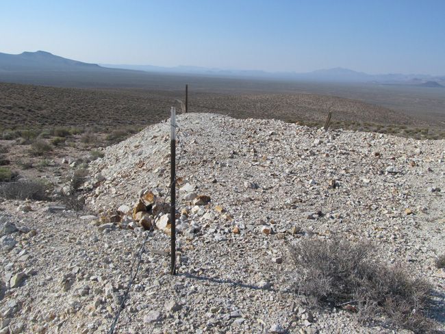
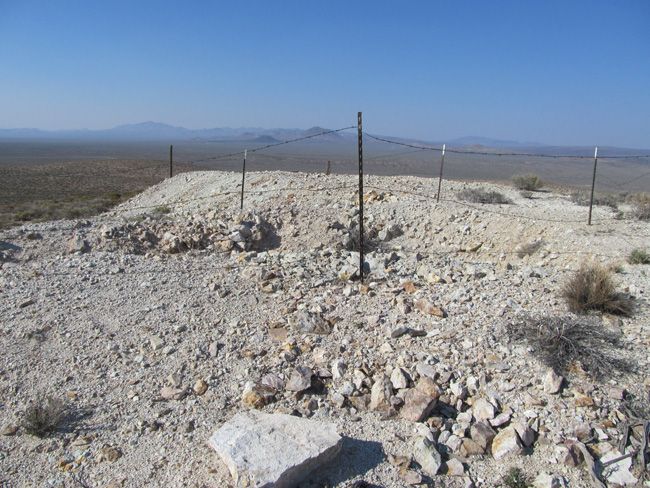
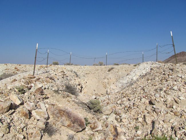
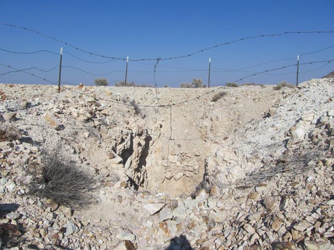
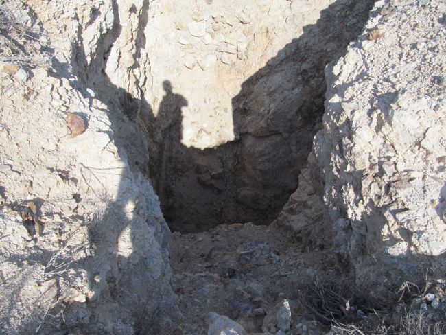
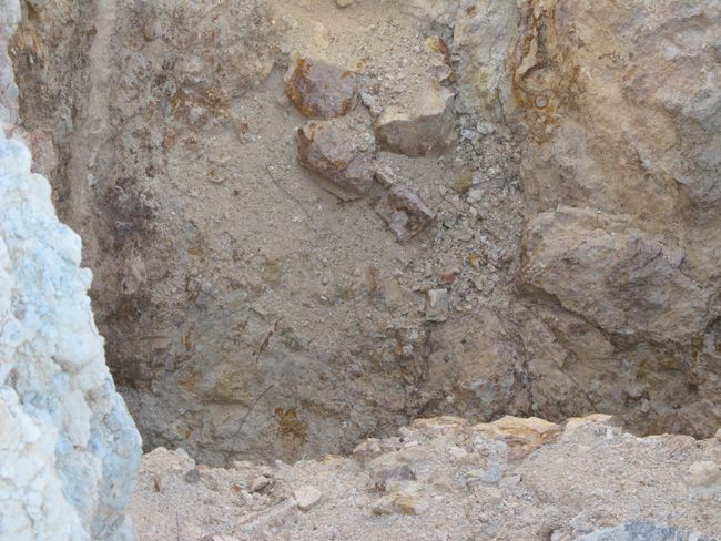
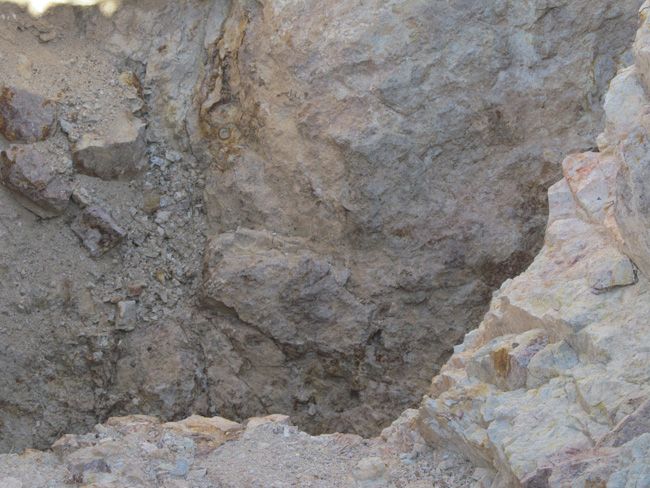
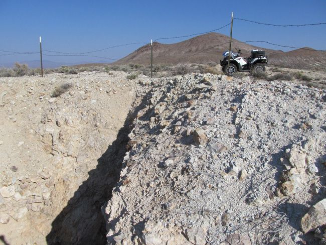
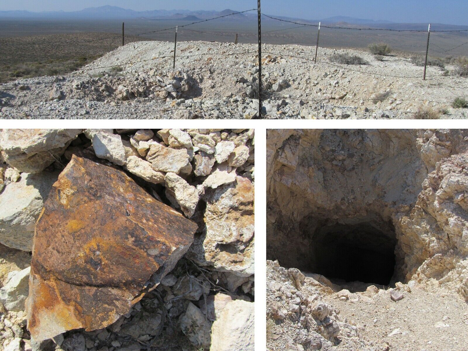
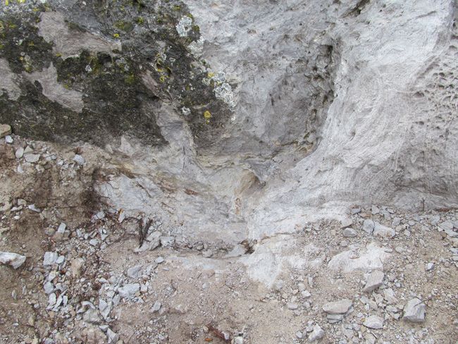
This mine in the Beatty Mountain Nevada Mining District is a massive shaft. The shaft declines at a 40 degree angle for 261 feet. The headframe is gone but the anchor points are still fairly solid, as is the mine. There is a large open cut in the vein. Our XRF gun picked up some very good gold AND silver  values based on just surface measurements in a few areas – worth crushing up  some rock and panning the gold to find even more most likely. Scroll down to see XRF readings. The vast majority of the tailings look to be worth  reworking using today’s  much more efficient processing methods.  
Beatty NV Mine Lode Claim

(Scroll down to see all pictures)
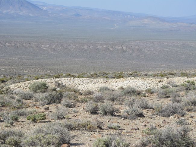
Lode Mining Claim

NV Mining Claim

Nevada Lode Claim 20.66 acre Claim

INDIAN RANCH Claim 

Come to Hike, Camp, Ride and Shoot – or come to pull some shiny rock$ out of the ground;-)

BEATTY MOUNTAIN MINING DISTRICT, NYE COUNTY, NV

ABSTRACT


  The Bare Mountain (Fluorine) mining district, located on and around Bare Mountain, southern Nye County, Nevada, has produced gold, mercury, fluorite, clay, silica, and some marble beginning in about 1905. Gold and fluorite production from separate deposits continues from the district.  Mineral deposits at Bare Mountain consist of gold-base metal-quartz vein deposits that are mainly confined to Precambrian and Cambrian host rocks and are located along the west slopes of the range. Gold-mercury-fluorite deposits in Precambrian-Cambrian sedimentary rocks and Tertiary volcanic rocks are located mainly along the north and east margins of the range. Copper, lead, zinc, cadmium, silver, and antimony are associated in the gold-base metal-quartz vein deposits and are interpreted to represent an early period of mineralization at Bare Mountain.  Gold, molybdenum, arsenic, and mercury are associated with fluorite in breccias and breccia pipes along the north and east margins of the range and are interpreted to represent a separate, later period of mineralization, possibly related to outer ring fracture zones of the nearby Crater Flat or Timber Mountain-Oasis Valley caldera complexes.
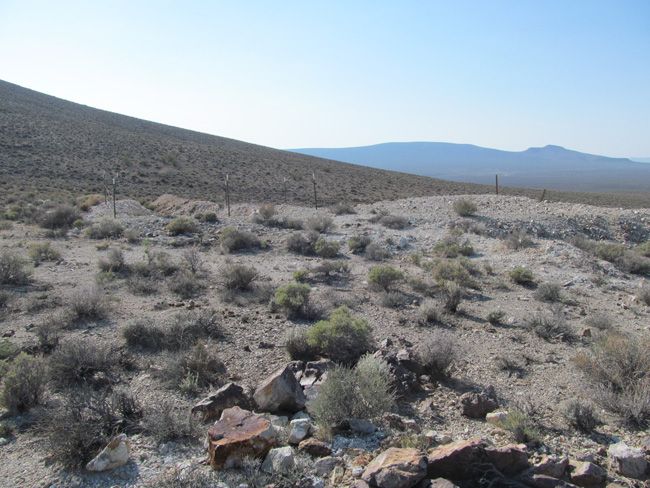
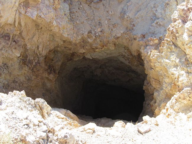
 photo 25_zps0b2f9576.jpg

 photo 34_zpse3ed22c7.jpg

 photo 35_zpse3fb72ce.jpg

 photo 36_zpsf77bd82f.jpg

 photo 37_zps57cbcbbc.jpg

 photo 38_zps00060ed8.jpg

 photo 39_zps8e52b9a2.jpg

 photo 40_zps69537c6d.jpg

 photo 41_zpscce57876.jpg

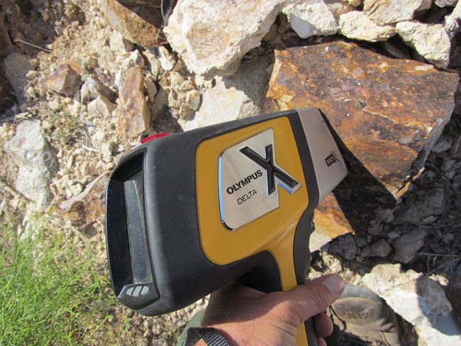
Portable X-Ray Fluorescence field units (also known as XRF guns) are commonly used by large commercial mining operations, well-equipped/funded private prospectors and even the Environmental Protection Agency (EPA) as well as many other government agencies for the most accurate field sampling in the quickest amount of time. In no way do we advise that you base all of your commercial mining valuations on just one or two samples (regardless of how accurate the method that you use to sample is), but this extremely precise and versatile $40,000 device is equipped with powerful X-ray tubes, specialized filters, highly advanced detectors, and multi-beam optimization that efficiently analyzes the chemistry of the rock, soil, and sediment that hosts metals, for a quick and extremely accurate analysis of even trace levels of metals like silver, lead, gold, platinum, copper and many other elements.

Today’s highly sensitive XRF Handhelds (we use the best unit available on the market – an Olympus Delta Premium with a full mining package) work by emitting an x-ray beam with enough energy to displace the electrons in the inner shells of the atoms that differ from the energy it gives off leading to a loss of energy in that atom. The specific loss of energy identifies the elements that are present in the sample. While fire assay is still the most widely used way to gauge how much or a particular metal (like gold and silver) is present in a sample since it can test the entire sample, it is an expensive process and takes many weeks to get an answer. XRF technology is the fastest and most accepted method in existence today for sampling a few millimeters (or deeper depending on the type of host rock sampled) into the surface of even the hardest rock, and the accuracy is measured in 1 to 2 parts per million (PPM)
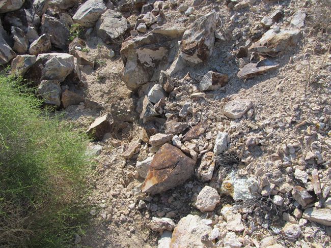
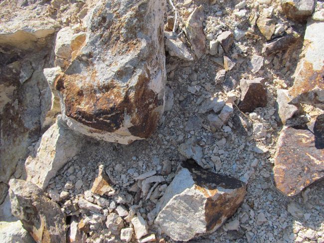
 photo 45_zps3f847f37.jpg

 photo 46_zps0caf7f75.jpg

 photo 47_zps7cd3e21c.jpg

 photo 48_zpsf32f27a7.jpg

 photo 49_zps0a85b9bf.jpg

 photo 50_zps3db3ac56.jpg

 photo 51_zps363186fd.jpg

 photo 52_zps968eb088.jpg

 photo 53_zpsed83ffe6.jpg

 photo 54_zps251c7871.jpg

 photo 55_zps9fe5ee45.jpg

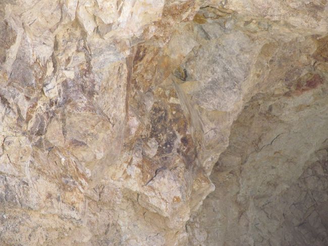
XRF shows that the Gold is at 1/4 per metric ton  Silver is at just under a half ounce per metric ton.

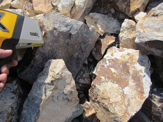
Note that these samples were all taken on rocks found on the ground’s surface.
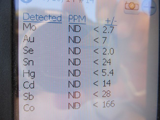
 photo 56_zpsb6fc1930.jpg

 photo 57_zps90e56ca0.jpg

 photo 58_zpsce73306b.jpg

 photo 59_zps1e49db25.jpg

 photo 60_zpsfa153cb6.jpg

INTRO


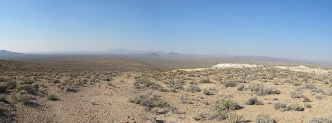
Bare Mountain lies along the northeast side of U.S. Highway 95 for about 1 S miles south of the town of Beatty in southern Nye County.,Nevada. Crater Flat, Yucca Mountain, and the Nevada Test Site lie to the east of Bare Mountain.  The wide Amargosa Valley and the California border are to the southwest of Bare Mountain, and the Bullfrog Hills are located to the northwest, west of the town of Beatty.  Bare Mountain stands out as an island of Paleozoic rocks, nearly surrounded by young volcanic rocks. It appears as a mass of older bedrock situated along the margins of the large caldera complexes that scallop it on its northern and eastern sides. Bare Mountain itself is an impressive but barren mountain mass composed mainly of colorful, zebra striped sedimentary rocks which are almost totally lacking in vegetative cover.


The first mining activity at Bare Mountain is credited to Mormons who found gold on the west slopes of Wildcat Peak on the southern tip of the mountain in about 1861. Ores were supposedly transported to the camp of Gold Center, on the Amargosa River south of present-day Beatty, for smelting (Carper, 1921).  The present era of mining activity, however, dates back to early 1905 when gold was discovered on the northeast end of Bare Mountain (Lincoln, 1923, p. 167).  Mercury was discovered in deposits on the northeast flank of the mountain in 1908, and the fluorite deposits in the north and east portions of the mountain were discovered in 1918 (Lincoln, 1923, p. 18). At Carrara, on the western side of the range, attempts were made between 1904 and 1936 to quarry marble for building material, but this activity never succeeded.  The most recent mining and exploration activity in the range is centered around the Sterling gold mine where disseminated gold deposits were discovered in 1980.
Pana of Site

GEOLOGICAL SETTING


Bare Mountain is composed almost entirely of late Precambrian and early to mid-Paleozoic sedimentary rocks that have been intensely deformed by folding and faulting. In general, Precambrian and Cambrian rocks crop out along the western slope and the southeast-trailing tail of Bare Mountain, while Ordovician through Mississippian formations make up the eastern half of the wide north end of the mountain mass. For the most part, the sedimentary rocks dip northward in successive blocks separated by right-lateral tear faults and flat thrusts (Cornwall, 1972, p. 31).


Some of the features mapped as thrusts may be alternately interpreted as gravity slide blocks and could be related to the collapse of the large caldera structures that border the Paleozoic bedrock of Bare Mountain. The area of lower relief, north of Bare Mountain and generally north of Fluorspar Canyon, is underlain by Miocene volcanic rocks. These volcanic rocks, which rim Crater Flat to the east as well, are highly faulted and consist largely of welded ashflow tuffs (Carr, 1982, p. 6). The ash-flow tuffs are interpreted by Carr 11982) as having two distinctly separate sources. The oldest tuff unit, Crater Flat Tuff, had as its source calderas in the area now occupied by Crater Flat.


This unit has been dated at 14-1 5 M.Y. (Christiansen and others. 1977. p. 947). The Crater Flat Tuff is overlain by the younger Paintbrush Tuff and Timber Mountain Tuff that are interpreted to have originated from the large Timber Mountain-Oasis Valley caldera complex which lies to the north of Bare Mountain (Carr, 1982. p. 8).


Altered rhyolite to rhyodacite dikes crop out generally along the eastern margin of Bare Mountain and cut across the narrow midsection of the range from northeast to southwest, transecting the Paleozoic bedrock. Carr (1982) reports a date of 13.9 m.y. for these dikes and states that they are the same age as lava flows that underlie the oldest Crater Flat Tuff unit. The dikes, in outcrop, form an arcuate pattern gently concave toward Crater Flat. Carr (1982) postulates that these dikes could represent outer ring dikes beyond the west wall of the Crater Flat collapse. Fluoriterich breccia pipes occur in conjunction with dikes at the Diamond Queen (Goldspar) Mine on the east edge of Bare Mountain, and the gold mineralization at the Sterling Mine occurs in an area cut by these dike rocks.
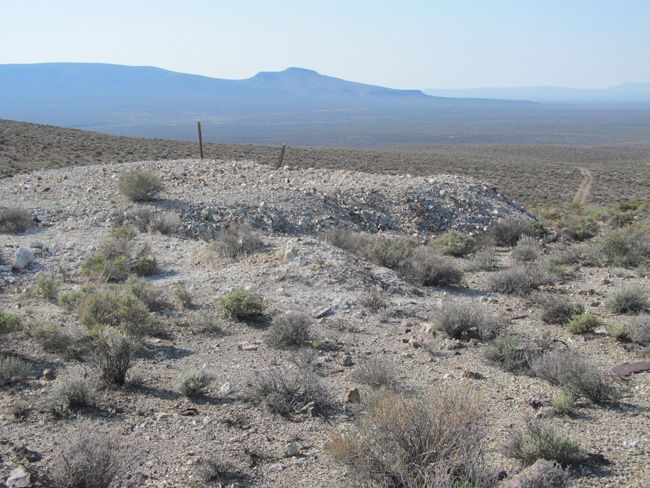
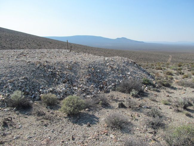
 photo 26_zpscbce1606.jpg

 photo 27_zps9e3f1ae0.jpg

 photo 28_zpsce1826fc.jpg

 photo 29_zpsf39244df.jpg

 photo 30_zps9957d47a.jpg

 photo 31_zps29a556bf.jpg

 photo 32_zps3f712085.jpg

 photo 33_zps4164e7c2.jpg

MINERAL DEPOSITS


Mineral deposits on and around Bare Mountain fall into two general categories: gold-base metal-quartz vein deposits hosted by Precambrian and Cambrian sedimentary rocks and gold-mercury-fluorite deposits that occur both in Cambrian sedimentary rocks and Miocene volcanic rocks.


The base-metal vein occurrences are scattered along the western slopes of Bare Mountain, and the gold and mercury occurrences are clustered in four general areas along the eastern and northern edges of the mountain.  Gold-bearing quartz veins, high in base metals, occur in the west-draining canyons and along the western slopes of Bare Mountain. The veins commonly contain calcite as well as quartz, and they fill fault zones and shears that cut Precambrian-Cambrian quartzites, dolomites, and schists. The veins follow northeast, north-south, and some eastwest shears and faults. Veins on some properties are described as following thrust fault zones. Weak skarns, with associated tungsten mineralization, have been reported from two areas, the Silver Peak claims just north of Steves Pass and the Bonanza and Grand Junction claims in Tungsten Canyon.  The metal sought at most of the properties in this area was gold, but silver, copper, lead, and zinc commonly provide the most visible minerals at the various properties.
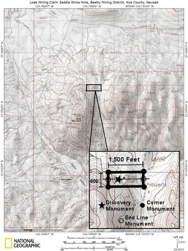

Mine Map

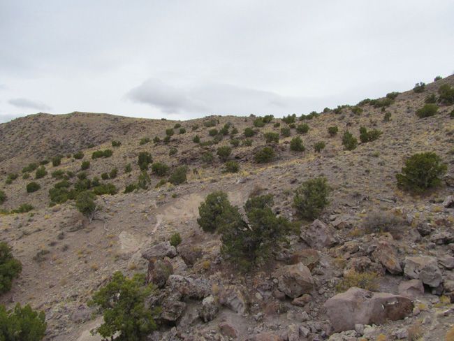
This entire area is relatively easily accessible by dirt roads which are well marked and well maintained. A 2-wheel drive car can get to this claim off of Route 95 via Beatty Wash Road, but I would recommend a good 4-wheel drive or even ATV’s to be able to access the entire claim that is not on the road.  The area is full of dirt roads, so a good map and a good GPS unit is a must, but we’ll show you exactly where it is on the map as well as provide you with the precise latitude and longitude of each corner marker, so finding it will not be a problem for you.
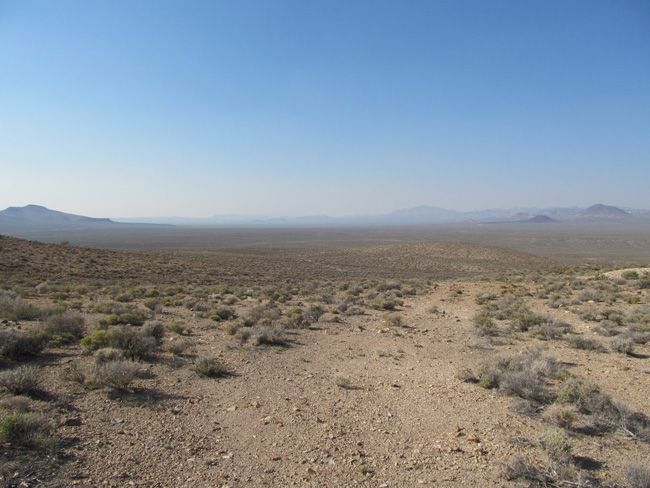
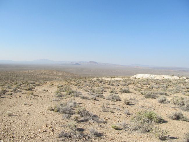
 photo 01_zps2fea9dcb.jpg

 photo 02_zpsd92075cb.jpg

 photo 03_zps03e82032.jpg

 photo 04_zps373f04df.jpg

 photo 05_zps80b33f9c.jpg

 photo 06_zps74e37993.jpg

 photo 07_zps8b8f3b91.jpg  photo 08_zps92f42178.jpg  photo 09_zps3dd750bc.jpg  photo 10_zpsd04573c6.jpg  photo 11_zps36ed8333.jpg  photo 12_zps97a3410d.jpg


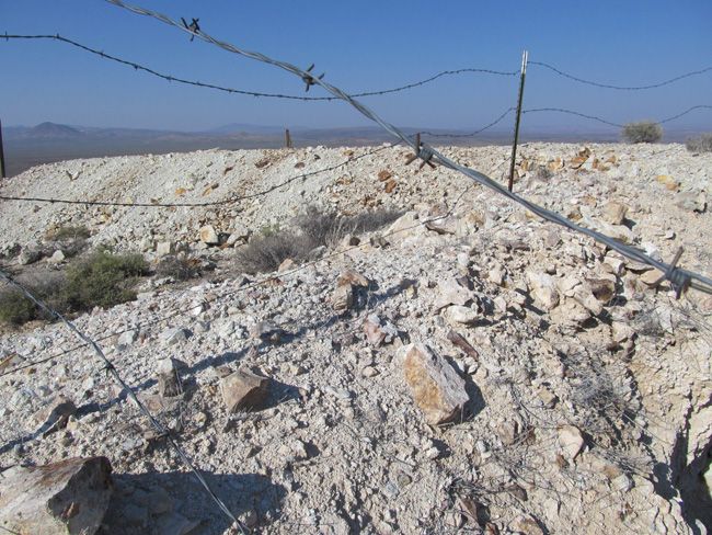
I advise caution whenever driving or hiking on this claim – the entire valley is dotted with abandoned mines – most of them are easy to see from a distance, but some of them are impossible to see until you are right on top of them. I would estimate that only 20% of them are roped or fenced off – the rest are wide open and you should be extremely careful if entering them.  A couple of spare tires or an air compressor and patch kit or at least a couple of cans of tire sealant is strongly recommended for obvious reasons! Also, be sure to bring in whatever water you may need, as there are almost no water sources in the area 10 months out of the year.
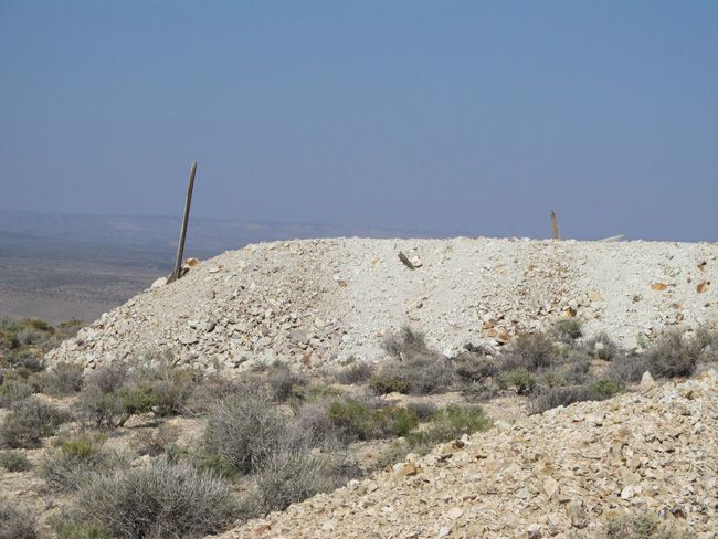
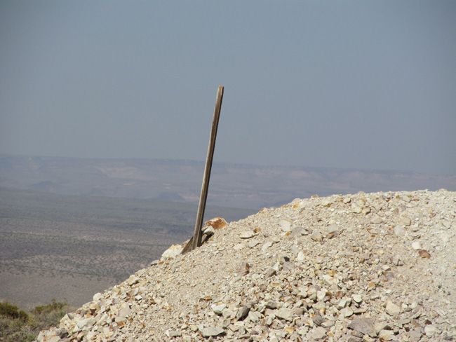
 photo 13_zps1ddf2f65.jpg

 photo 14_zps06f63dae.jpg

 photo 15_zpsc1972aad.jpg

 photo 16_zpsd872d430.jpg

 photo 17_zpsaae1e361.jpg

 photo 18_zps9e56fe5c.jpg

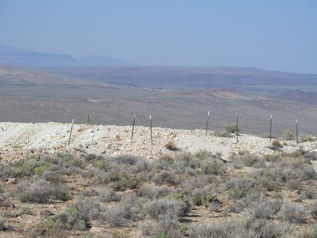
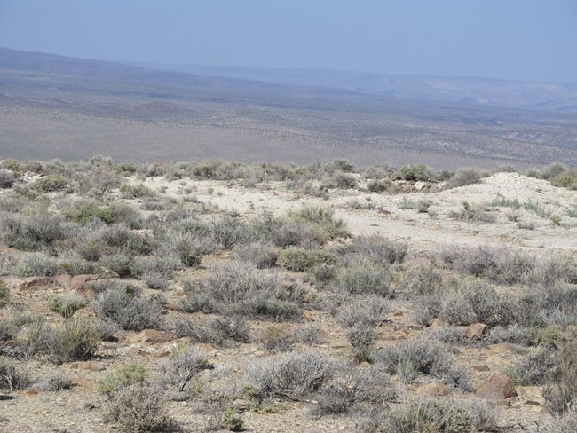
Note that all of the pictures of this claim were taken by the team and/or myself on a recent visit to this property.

All Pictures are of the actual property – no stock photographs were used
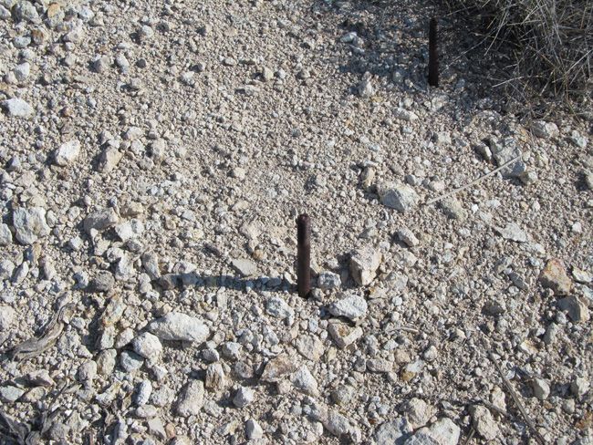
 

 photo 19_zps53691d4c.jpg

 photo 20_zps4c1f1ceb.jpg

 photo 21_zps26b6bcb0.jpg

 photo 22_zps10e016e3.jpg

 photo 23_zpsd7c6ded9.jpg

 photo 24_zpsd8f8b795.jpg

 photo 42_zps0668a66a.jpg

 photo 43_zps2b2d5a81.jpg

 photo 44_zpsd960ef06.jpg

 photo 61_zpsab54cd64.jpg

 photo 62_zps4b40a6aa.jpg

 photo 63_zpsf06566c5.jpg

 photo 64_zps8f63a7bc.jpg

 photo 65_zpsa9020fad.jpg

 photo 66_zps6c6e5e37.jpg

 photo 67_zps3f55f719.jpg

Item specifics

Seller Notes
“Who are we? We’re A+ Rated with the BBB. Innovator of the year, 2016 E&MJ. Conservation award …
Type of Claim
Lode
Featured Refinements
Mining Claim
Property Address
Beatty, NV 89003
State/Province
Nevada
Seller State of Residence
California
Zip/Postal Code
89003
Zoning
Mixed
City
Beatty
Acreage
20.66
Type
Unpatented Mining Claims
See Map
Portions of this page and links may be provided by third party content providers such as MapQuest.com, and they are solely responsible for such content.

2 x 20 Acre Mining Claims Yreka California Humbug Creek MehatMeBugBug 1 & 2

2 x 20 Acre Mining Claims Yreka  California Humbug Creek MehatMeBugBug 1  & 2

Price: 3,500.00 USD

2 x 20 Acre Mining Claims Yreka California Humbug Creek MehatMeBugBug 1 & 2

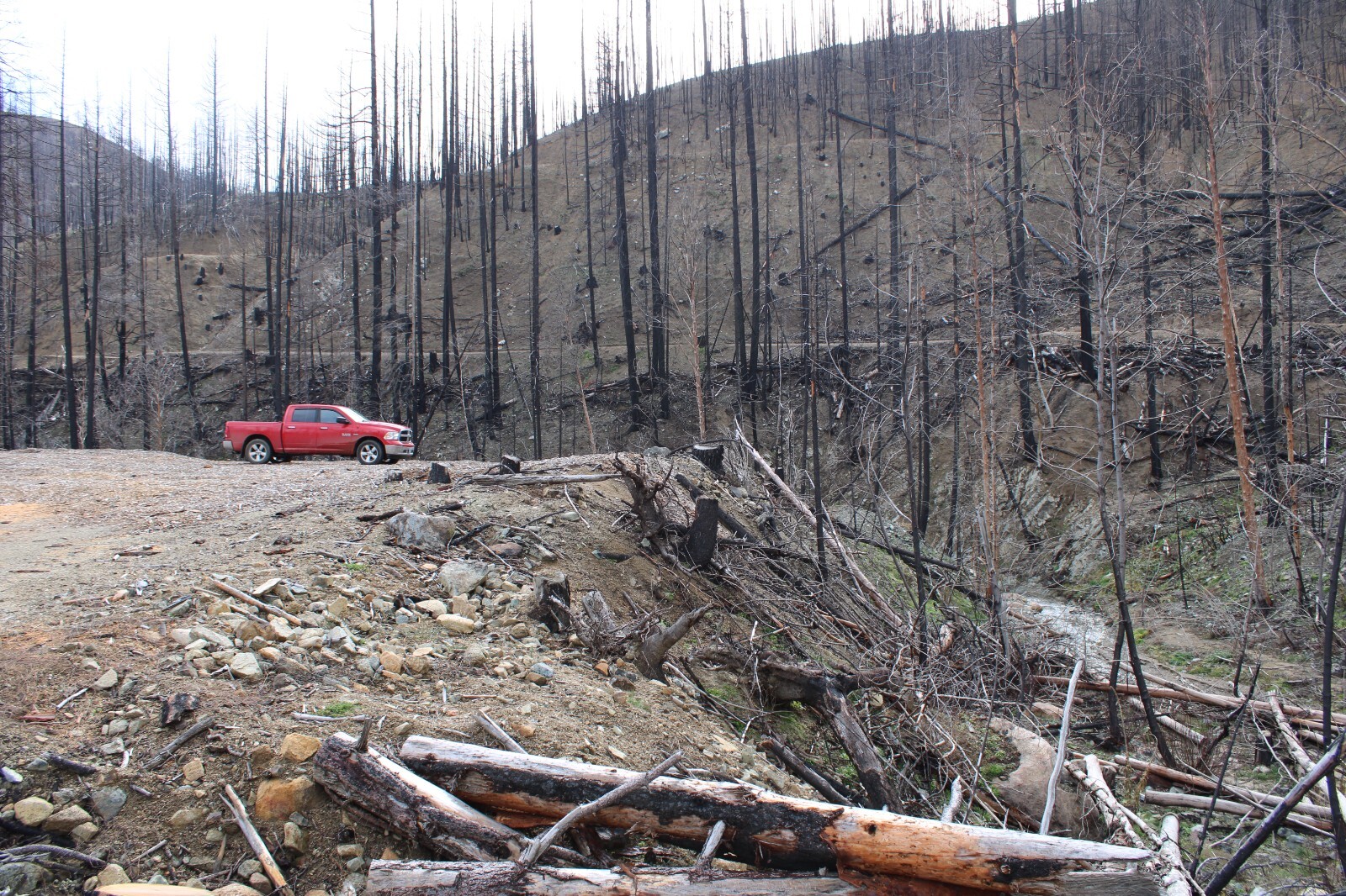
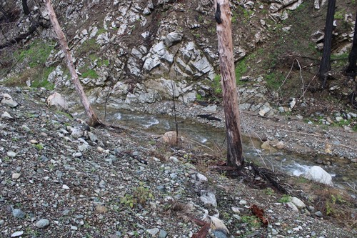
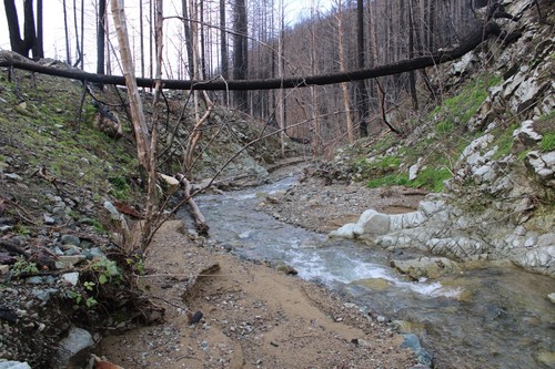
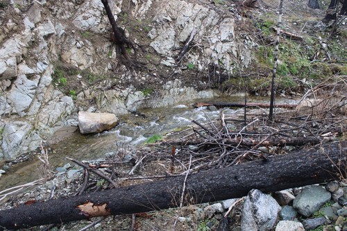
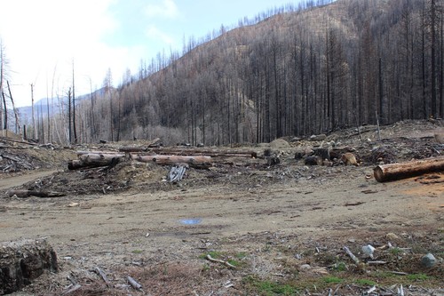
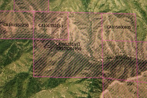
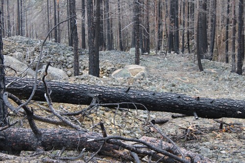
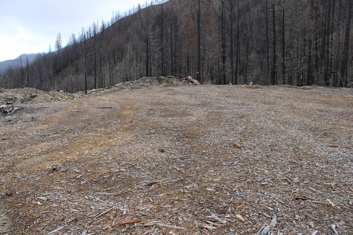
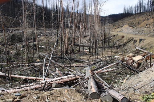
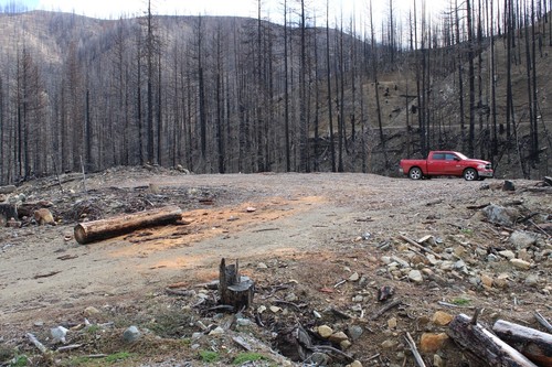
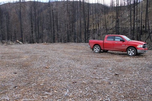
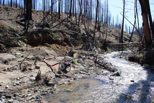
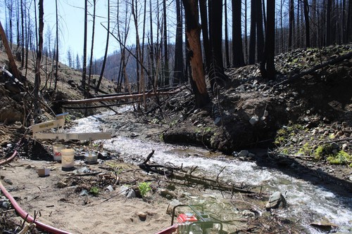
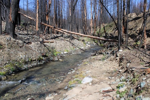
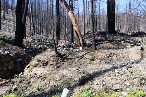
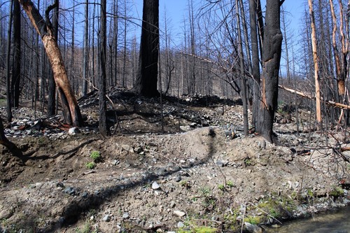
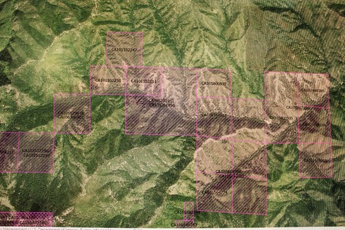
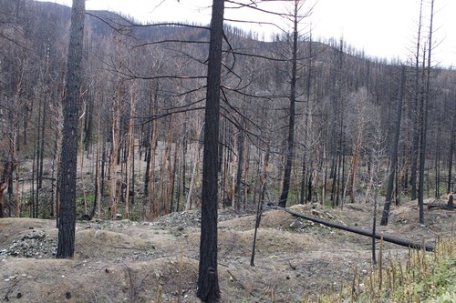
$3,500.00  gets you both 20 Acre Gold Placer Claims,  for sale is “MehatMeBugBug 1 & 2” CA105261951 and  CA105261951  I own both claims, as you can see there was a recent fire up there, easy access to tons of tailings piles and a huge amount of humbug creek.  The claims include a portion of the bottom of sucker creek and ryder gulch as well as lawson gulch which has an abandoned mine shaft at the bottom just off the claim.  About a half hour or so drive on a dirt road from Yreka which is right off the I-5 in Siskiyou County.  Well maintained road for any vehicle as well as RV or trailer. There is a huge flat spot to set up any RV or trailer on #2. Creek has year-round water, late fall slows down a bit to running a small sluice box, but a highbanker works great. The water in this creek is very clean. Great area to explore and if you have a motorcycle or quad, you won’t be disappointed. Once payment is received, I will send you a quit claim and begin the BLM transfer and you will be able to start mining and put up mining claim signs on your claims wherever you like, right now there is one at each claim. the first pictures are of #2, All fees are paid until September. If you have any questions and are interested please ask. If you plan to buy this claim, Pay Pal would be the preferred way, so please contact me for info.

Item specifics

Seller State of Residence
Oregon
State/Province
California

STUNNING VIEW OF MT. SHASTA. Owner finance. Zero down, Zero interest $ 299/month

STUNNING VIEW OF MT. SHASTA. Owner finance. Zero down, Zero interest $ 299/month

Price: 26,900.00 USD

STUNNING VIEW OF MT. SHASTA. Owner finance. Zero down, Zero interest $ 299/month

  • MINIMUM BID BEGINS AT 1/3 OF REALTOR’S C.M.A. !!!!
  • ZERO DOWN PAYMENT….. ZERO % INTEREST RATE !!!!
  • FIRST….THE REQUIRED BORING STUFF….
  • I HAVE SOLD OVER 500 PROPERTIES ON EBAY ALONE IN THE LAST 23 YEARS. ALTHOUGH I HOLD A REAL ESTATE BROKER’S LICENSE IN TWO STATES, CALIFORNIA AND OHIO, I SELL MY OWN PROPERTIES, NOBODY ELSE’S. THEREFORE I AM NOT A THIRD PARTY REPRESENTATIVE ACTING AS A FIDUCIARY. ALL OF MY PROPERTIES THAT I SELL ARE DEEDED IN MY NAME PERSONALLY. I CURRENTLY OWN OVER 80 VACANT LAND PARCELS IN California, Nevada, Washington, Utah, Alaska, Ohio and Michigan and all available for sale on ebay in the forthcoming 12 month period. SO BUY FROM A TRUSTED EBAY SELLER OF REAL PROPERTY !
  • BIDDING BEGINS AT 1/3 OF REALTORS’ ESTIMATES OF CURRENT FAIR MARKET VALUE (OCTOBER 2023). NO RESERVE AMOUNT TO BE MET. ZERO DOWN PAYMENT. ZERO INTEREST RATE.
  • YOU ARE BIDDING ON THE FULL PURCHASE PRICE OF THIS EXTRA LARGE BEAUTIFUL LAKE SHASTINA UNIMPROVED HOME LOT. NO RESERVE AMOUNT TO BE MET. BIDDING BEGINS AT JUST 1/3 OF REALTORS ESTIMATES OF FAIR MARKET VALUE  ($ 27,900 – 04/2024), or $ 8,900. HOW DO I ARRIVE AT THIS AMOUNT ? SIMPLE. I CONTACT OTHER REALTORS WITH SIMILAR PROPERTIES FOR SALE, (OR SOLD), LISTINGS AND ASK THEIR OPINION OF FAIR MARKET VALUE. THEREFORE, IF THIS AUCTION DOES NOT RECEIVE A SUCCESSFUL WINNING BID FOR ANY REASON I WILL THEN LIST THIS PROPERTY WITH ONE OF THESE LOCAL REALTORS. I AM SHOWING CURRENT COMPARABLY PRICED PROPERTIES BELOW. LOT 43 = ( .73 of an acre) OR LOT 44 = (.75 of an acre) on market for $ 22,000 EACH ( $ 44,000 for both -CASH SALE ONLY). ALTHOUGH BOTH OF THESE LOTS HAVE A GREAT VIEW THEY HAVE A PRETTY STEEP SLOPE AND ARE NOT EASILY WALKABLE. MY LOT HAS A VERY GENTLE DOWNGRADE FROM THE ROAD WITH A PREMIUM MOUNTAIN VIEW.

THIS IS NOT A BID AND ASSUME AUCTION. YOU WILL NOT BE ASSUMING AN ARTIFICIALLY HIGH LOAN AMOUNT. I DON”T RUN MY AUCTIONS THAT WAY. YOU DETERMINE THE VALUE OF THIS PROPERTY.

SEE MY OTHER LOTS NOW ON AUCTION !


++++++ WINNING BIDDER MUST EMAIL ME WITH THEIR CONTACT INFORMATION WITHIN 12 HOURS OF AUCTION ENDING. THIS INFORMATION MUST INCLUDE FULL LEGAL NAME(S) TO APPEAR ON THE DEED, MAILING ADDRESS, DAYTIME PHONE NUMBER, EMAIL ADDRESS AND METHOD OF PAYMENT. ++++++

 PLEASE ASK ALL QUESTIONS PRIOR TO PLACING A BID, NOT AFTER THE AUCTION ENDS. BIDDERS ARE REQUIRED TO CONDUCT THEIR DUE DILIGENCE BEFORE PLACING THEIR INITIAL BID.

  • PLEASE SEE MY OTHER NORTHERN CALIFORNIA  LOTS NOW ON AUCTION.

 YOUR NEW HOME / RECREATIONAL LOT IN BEAUTIFUL SISKIYOU COUNTY AWAITS !

LOCATED ON A PAVED RD. (Windmill Dr.) just next to (south of) home at 15005 Windmill Dr. (see photos below of the next door neighbor’s home. Google this address to see recent listing of this home for sale.)

ALL UTILITIES TO THE LOT….NO TIME FRAME (IF EVER) TO BUILD A HOME.

THERE ARE NO MONTHLY LOT RENTAL FEES AS YOU OWN THIS LOT OUTRIGHT ! JUST $ 395 PER YEAR COVERS LAKE SHASTINA POA FEES. There is a standby water bill that all owners pay in the amount of $ 125.50 per half year.

IF YOU ARE NEW TO EBAY WITH FEEDBACK SCORE OF LESS THAN 10 PLEASE CONTACT ME BEFORE BIDDING OTHERWISE YOUR BID WILL BE REJECTED.

BIDDING BEGINS AT JUST $ 8,900.00, Your bid will increase the purchase price, not the down payment. Winning bidder pays $ 395 closing costs in addition to winning bid. ZERO down, Zero interest owner financing offered, regardless of winning bid amount. Just pay $ 299 per month. If, FOR EXAMPLE, winning bid is $ 18,000 this note would be paid off in 60 months (5 years). If, FOR EXAMPLE, winning bid is $ 24,000 this note would be paid off in 80 months (6 years, 8 months). This formula works for ANY winning bid amount based on principal no interest payments only. NO BALLOON PAYMENT….note is fully amortized for the entire term  and you can always prepay ANY AMOUNT towards your payoff balance with ON PREPAYMENT PENALTIES ! Annual HOA fee ($ 395) and water standby bills ($ 251) will be paid to Lake Shastina POA and water District by seller and reimbursed by buyer and will be prorated and included monthly as part of each monthly payment. 

  • IDEAL HOME LOT OR RECREATIONAL LOT. THIS PARCEL IS 2 – 3 TIMES THE SIZE OF THE AVERAGE LAKE SHASTINA LOT (.73 ac. compared to .25 – .33 ac lots)

  • STUNNING VIEWS OF MT. SHASTA FROM ANYWHERE ON THIS PROPERTY. (Oh, did I happen to mention STUNNING views ?)

  • LOCATED JUST OUTSIDE OF THE BEAUTIFUL MOUNTAIN TOWN OF WEED, CALIFORNIA IN THE HIGHLY DESIRABLE COMMUNITY OF LAKE SHASTINA.

  • TITLE IS BY GRANT DEED which will be recorded upon receipt of final payment. Please note that aerial photos provided by the county website quite often show the lot/property lines as being offset to some degree and it may appear that a nearby structure is encroaching on the property. Do not use these images for erecting fence or building of any structure. Please verify all information to your satisfaction prior to bidding.

  • ++++++++++++++++++++++++++++++++++++++++++++++++++++++++++++++++++++++++++++++++++++++++++++++++++

  • +++++++++++++++++++++++++++++++++++++++++++++++      

  • NOW FOR THE INTERESTING STUFF……

  • SISKIYOU COUNTY, CALIFORNIA

  • “GORGEOUS” parcel and view – or should I say “STUNNING” ….can’t decide which is a better adjective to describe this lot and view…. no better view of Mt. Shasta anywhere in Lake Shastina than from THIS PARTICULAR PARCEL….  includes a 20 foot wide portion for driveway access – see plat map below, buyer to verify)

  •  NO RESERVE AMOUNT – BIDDING BEGINS AT JUST 1/3 COMPARABLE LOTS VALUE, AND REALTORS COMPETITIVE MARKET ANALYSIS (FAIR MARKET VALUE) OF $ 26,900 …. OR JUST $ 8,900.00. 

  • FIRST MONTHLY PAYMENT (due by June 3, 2024) OF $ 299 due along with prepaid closing costs of $ 395 at end of auction ( $ 694 total). Overnight delivery (NO USPS PRIORITY MAIL, NO SIGNATURE REQUIRED UPON RECEIPT), Cashiers Check with tracking number, Wired funds, Zelle (online banking) & Chime only.

  • RARE FIND – EXTRA LARGE LOT WITH FABULOUS Mt. SHASTA VIEW. What an economical way to have your own getaway in Siskiyou County. You can use this as a weekend getaway or live there full time. Note: THIS IS A VACANT HOME LOT….NO structures included. Any photos of home(s) in this ad are of other nearby properties.

  • CASH SALE OR ZERO INTEREST, ZERO DOWN PAYMENT FINANCING OFFERED. PLEASE READ THIS ENTIRE LISTING AS IT IS FULL OF THE APPROPRIATE INFORMATION AND WILL ACT AS A PURCHASE AGREEMENT AND/OR SUPPLEMENT TO A REAL ESTATE PURCHASE AGREEMENT AT END OF AUCTION.

  • WEED (Siskiyou County) CALIFORNIA – Located on Windmill Drive.  Parcel number (APN) 106-200-040-000, LOT 89, Lake Shastina Unit No. 3. 

  • LOT SIZE  – buyer to verify – see plat map. APPROXIMATE GPS: 41.537784, -122.367374. 

  • ANNUAL REAL ESTATE TAXES WILL BE BASED ON APPROXIMATELY 1 % OF NEW SALES PRICE AND ARE PAID UP TO DATE. The next tax bill for the period July 1, 2024 – June 30, 2025 will be mailed out in October 2024 and first installment will be due by December 1, 2024. Buyer to be responsible for all taxes beginning July 1, 2024 and forward. 

  • THIS LOT IS SIMPLY GORGEOUS. IN ADDITION TO UNPARALLELED STUNNING VIEWS OF MT. SHASTA THIS LOT IS 2 X – 3 X LARGER THAN THE AVERAGE LAKE SHASTINA LOT.

  •  NO TIME LIMIT TO BUILD (if ever !)

LAKE SHASTINA POA DUES ARE ONLY $ 395.00 PER YEAR INCLUDES ROAD MAINTENANCE AND COMMON GROUNDS UPKEEP !  

Actual photos of the lot are pictures # 1, 2, 3 & 4 above (Photo # 1 is a telephoto “close-up” view of Mt. Shasta from this lot. Photos # 5 &  6 are of the neighbor’s home immediately to the north located at 15005 Windmill Dr., Weed, CA. Photo # 7, 8 & 9 are of plat map/aerial photos of property.

FIVE COMPARABLE NEARBY (CLOSEST TO MINE) LOTS FOR SALE AS OF 04/17/2024. NONE OF THESE LOTS OFFER OWNER FINANCING- BUT MY LOT DOES !:

1. LOT 43 DWINNELL (.73 ac – steep slope, great view) $ 22,000

2. LOT 44 DWINNELL (.73 ac – steep slope, great view) $ 22,000

3. LOT 70 – 170, 171 DWINNELL (.98 acres, nice view)  $ 30,000

…….and some SMALLER sized lots listed nearby….

1. LOT 88 DEER LN.   (.27 ac – 1/3 m/l size of my lot)     $ 20,000

2. LOT 77 DEER LN.   (.27 ac – 1/3 m/l size of my lot)     $ 20,000

3. LOT  2  DEER LN.   (.30 ac – my lot is 2 1/2 X larger)  $ 19,004 LOT 0 DRIFTWOOD LN. CLOSE TO LAKE (.39 ac)       $ 30,000

  • PLEASE NOTE THIS IS  EITHER AN ALL CASH SALE OR FINANCING IS OFFERED. THE TOTAL AMOUNT DUE AT END OF AUCTION = WINNING BID AMOUNT  + $395 (IF ALL CASH SALE) OR FIRST MONTHLY PAYMENT OF $ 299 + $ 395 CLOSING COSTS ($ 694 TOTAL)

  • SUBMIT YOUR BEST BID BETWEEN NOW AND AUCTION’S END. WINNING BIDDER WILL BE REQUIRED TO DEPOSIT FULL AMOUNT – $ 395 (closing fee + WINNING BID ) WITHIN 72 HOURS of end of auction. Please submit payment via bank-wired funds, Zelle or Chime ONLY. Sorry, no Paypal or Venmo as neither accepts payments for real estate purchases.

  • YOU WILL NEED TO CONDUCT YOUR OWN DUE DILIGENCE AND HAVE ALL OF YOUR QUESTIONS ANSWERED  PRIOR TO PLACING YOUR INITIAL BID.  MAKE PHONE CALLS, VIEW PROPERTY, CONDUCT COMPS. IT IS UP TO YOU TO CONTACT THOSE “IN THE KNOW”, I.E. LOCAL BUILDING AND PLANNING OFFICES, ETC. TO VERIFY ANY STATEMENTS IN THIS LISTING. MY ONLY OBLIGATION IS TO PROVIDE THE PROPERTY’S LEGAL DESCRIPTION, APPROXIMATE LOCATION, LOT AND AND PARCEL NUMBER.

  • TOTAL AMOUNT DUE AT END OF AUCTION: WINNING BID AMOUNT PLUS $ 395 CLOSING COSTS (IF ALL CASH PURCHASE) OR $ 694 IF FINANCED PURCHASE (First monthly payment of $ 299 due by June 1, 2024 plus $ 395 settlement fees).. 

 CASH SALE OR ZERO DOWN, ZERO INTEREST FINANCING TERMS ARE OFFERED. 

*  $ 395 CLOSING COSTS INCLUDES DEED PREPARATION, PROMISSORY NOTE, RECORDING FEES, TRANSFER TAXES, OVERNIGHT DELIVERY FEE(S), AND 2024 PRORATED LAKE SHASTINA P.O.A. DUES. PURCHASE OF TWO OR MORE LOTS AT THE SAME TIME BY THE SAME INDIVIDUAL(S) OR ENTITY WILL ONLY BE CHARGED AN ADDITIONAL $ 295 CLOSING FEE PER LOT TO COVER DEED PREPARATION, NOTARIZATION AND RECORDING FEES. (SEE MY OTHER CALIFORNIA LOTS NOW ON AUCTION.)

PLEASE READ ALL INFORMATION…… I have allowed a full 30 day auction period to allow for all interested parties to visit the property and have all of their questions answered. 

This auction ends 8:00 PM PDT Thursday evening, May 30, 2024. 

Please take the time to satisfy yourself as to the location, desirability and utility of this parcel for your specific purposes and needs. This process is called “conducting your due diligence”.  This lot is ready to build on, but there is no time frame to do so….. IF EVER ! PLEASE VERIFY THIS, AND ALL OTHER INFORMATION, on your own. There are no back taxes owed on this lot. I, as Seller, will record deed once total balance of purchase price is paid in full. A modest $ 395 closing fee to cover preparation of the deed and notarization, transfer taxes, plus county recording costs. (Additional properties bought by, and deeded to, the same buyer or entity within 30 days will only pay a $ 295 closing fee per each additional parcel in order to cover deed preparation, recording fees, P.O.A. dues, etc.)

Please do not bid until you read the following information and agree to accept the terms: Your winning bid is a contract, it is not a starting point for further negotiations. You are required to conduct your due diligence PRIOR TO PLACING A BID. If you have any questions, please ask BEFOREHAND, not after. Property is sold in lieu of using a formal escrow company. Should buyer desire to use an outside escrow company or independent third party, including attorneys fees and all associated costs, including but not limited to, deed preparation, closing fee, title research and any and all title insurance fees and premiums and the like, will be borne by the buyer. Bidder will need to contact the necessary person/office with any questions as to building restrictions/questions, water, electric accessibility and the like. This property was purchased for county-owed back taxes when initially acquired and tax bills have always been paid current since. Aerial photos indicate the general area where the lot is located and photos are not guaranteed to be 100% accurate, but are shown for general informational purposes and a guideline only. It is buyer’s responsibility to physically visit property or make other inquiries as to determine exact parcel’s location. Buyer to hold seller harmless for any misinformation contained herein as seller may or may not have actually visited the property and has had no independent survey. Seller’s sole responsibility is to provide parcel’s legal description, APN and parcel’s general location. Any and all other information, other than parcel number and legal description, contained herein must be independently verified by buyer as rules/regulations may, and can, change over the years. Real estate taxes are paid current as of last bill sent. New owner will be responsible for the tax bill for the period July 1, 2024 – June 30, 2025 (prorated) and thereafter. Current taxes, POA fees and water standby fees are paid and current through June 30, 2024. Any required taxes, POA/HOA dues and real estate related recurring costs (i.e. water stand by bills, etc.) on this property covering the periods beginning that day this auction ends and forward will be the responsibility of the winning bidder and payable when due.

Winning bidder is required to email me with their contact information IMMEDIATELY at end of auction. This contact information must include: (1) Full legal name(s) of grantee(s) exactly as they are to appear on the deed, (2) Desired vesting:  (example, John Q. Doe and Mary A. Doe, HUSBAND AND WIFE AS JOINT TENANTS), (3) Mailing address where you want future tax bills and deed to be sent, (4) your direct email address, (5) Daytime telephone number. (6) Method of payment. This information is required immediately for preparation of the deed, promissory note and any written agreement.

A $ 395 non-refundable deposit is due within 24 hours (if financed).  Balance of payment (winning bid amount) is due within 48 hours after that, (72 hours after auction all funds are due). If cash sale full amount (winning bid + $ 395 closing costs) is due within 72 hours after auction’s end. Bank-wired funds, Zelle, Chime in some instances such as deposit, are accepted. No checks of any kind accepted. If an all cash sale buyer must send payment via delivery method that includes tracking number (USPS Priority Mail, FedEx, etc.) and is to be RECEIVED by seller within the above mentioned time period. Full amount is due within 48 hours after initial deposit is paid along with any required signed paperwork, such as Purchase Agreement, Promissory Note, Deed etc.  Buyer understands that I, as seller, have no control over the length of time that the county recorder takes to record and return a recorded deed. Please allow 4 – 8 weeks  minimum for the entire process to be completed and recorded deed to be returned by the county recorder.  Depending on local requirements I will issue a newly recorded grant deed or quitclaim deed to the winning bidder. This information constitutes all information required and shall suffice for contract terms. BY PLACING AN BID YOU, AS BUYER, AGREE TO THE TERMS AS STATED ABOVE. 

Item specifics

Seller State of Residence
Ohio
Type
Homesite, Lot
Property Address
Windmill Dr.
Zip/Postal Code
96094
Zoning
Residential
City
Weed
State/Province
California
See Map
Portions of this page and links may be provided by third party content providers such as MapQuest.com, and they are solely responsible for such content.

Topaz Mountain Gold Mine Utah Mining Claim Gems Precious Rocks Gemstones UT Juab

Topaz Mountain Gold Mine Utah Mining Claim Gems Precious Rocks Gemstones UT Juab

Price: 6,775.00 USD

Topaz Mountain Gold Mine Utah Mining Claim Gems Precious Rocks Gemstones UT Juab

Utah Placer Claim

20 Acre Unpatented Placer Mining Claim on Federal Land in Juab County, Utah


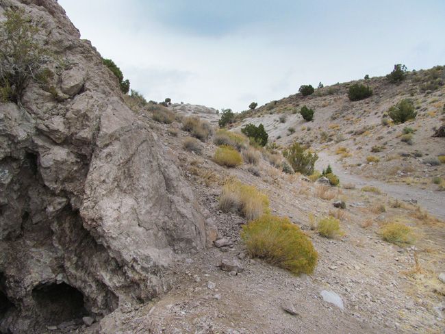
With this claim you will be getting the exclusive mineral rights to 20 acres on an excellent spot located in Juab County.

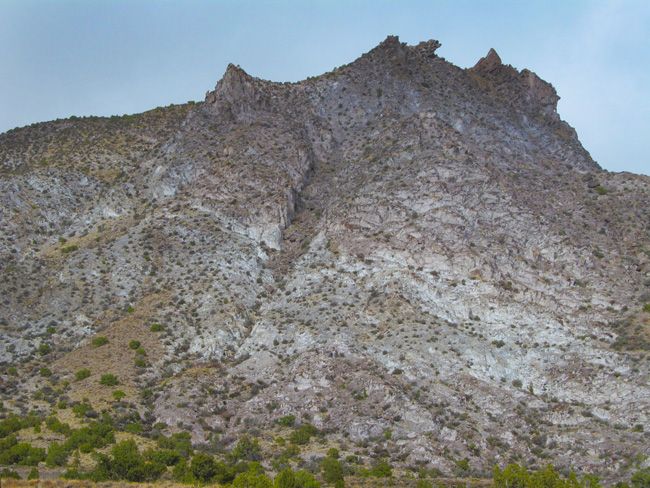
Topaz Mountain is a summit in the Thomas Range of Utah, east of the Thomas caldera. The summit and surrounding area is known for its relative abundance of semiprecious minerals including topaz, red beryl and opal Topaz is a mineral that is formed as fluorine-rich vapors rise from cooling lava flows or intrusions of magma. That is the origin of the crystals found at Topaz Mountain in Utah.          

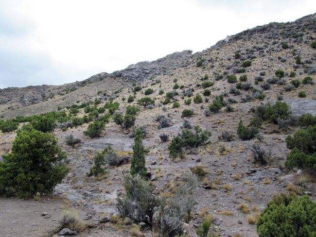
claim

The crystals formed within cavities of the Topaz Mountain Rhyolit, a volcanic rock which erupted approximately six to seven million years ago (Tertiary Period) from volcanic vents along faults in the area. Clear Topaz can be seen glittering in the sunlight all over the ground. Washes are a great place to find clear Topaz. But if you’re looking to find the more sought after amber colored Topaz you will have to do a little work. You want to search for bushes or any other kind of vegetation growing out of the cracks in the Rhyolite, this is a sign of weakness in the rock, and is usually a great location to find Topaz. Probe these areas with your screwdriver to find soft spots that may lead you to a pocket containing amber colored Topaz.           

Topaz is a semiprecious gemstone that occurs as very hard, transparent crystals in a variety of colors. Topaz crystals, such as those found at Topaz Mountain, are naturally amber colored, but become colorless after exposure to sunlight. Topaz forms within cavities of the volcanic rock, rhyolite, from eruptions that occurred six to seven million years ago during the Tertiary Period. Topaz is embedded in the rhyolite rock, and also found loose on the slopes and arroyos    

Topaz occurs in a variety of colors. Colorado topaz is usually pale blue, while Utah topaz is a sherry brown or amber color.       

Utah topaz is light sensitive and, if left exposed to strong sunlight, rapidly fades until the color is gone and the crystal is clear. Topaz Mountain, located in the Thomas Range of Juab County, is one of the world’s premiere spots for finding topaz.     

The topaz crystals at Topaz Mountain are naturally amber colored, but become colorless after exposure to sunlight. The crystals formed within cavities of the Topaz Mountain Rhyolite, a volcanic rock which erupted approximately six to seven million years ago (Tertiary Period) from volcanic vents along faults in the area. Single colorless topaz crystals can be found in the washes around Topaz Mountain. Crystals are usually less than an inch long. Larger amber crystals or clusters of topaz and other minerals can be found by breaking open the white rhyolite to find cavities.

Topaz Mountain is located on the southern end of the Thomas Range. This range is very popular to rock collecting enthusiasts. Topaz, Utah’s state gem; is a semiprecious gemstone that occurs as very hard transparent crystals in a variety of colors. The Topaz crystals at Topaz Mountain are naturally amber colored, but become colorless after exposed to sunlight.   

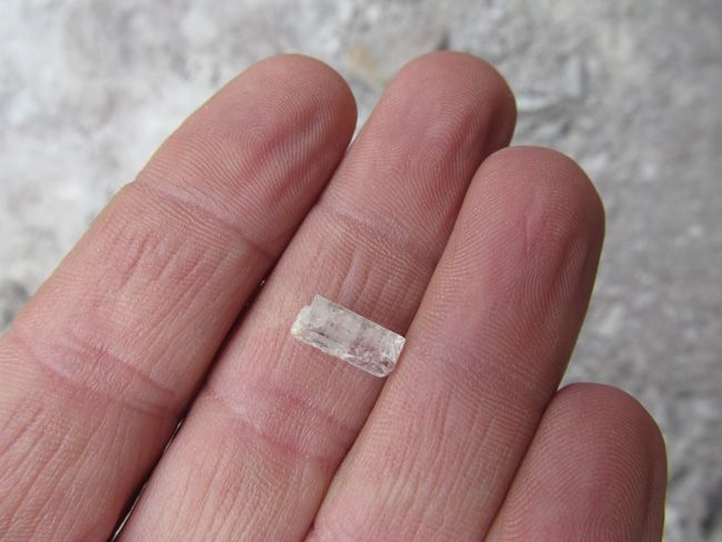
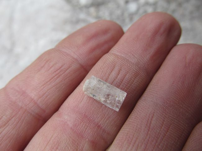
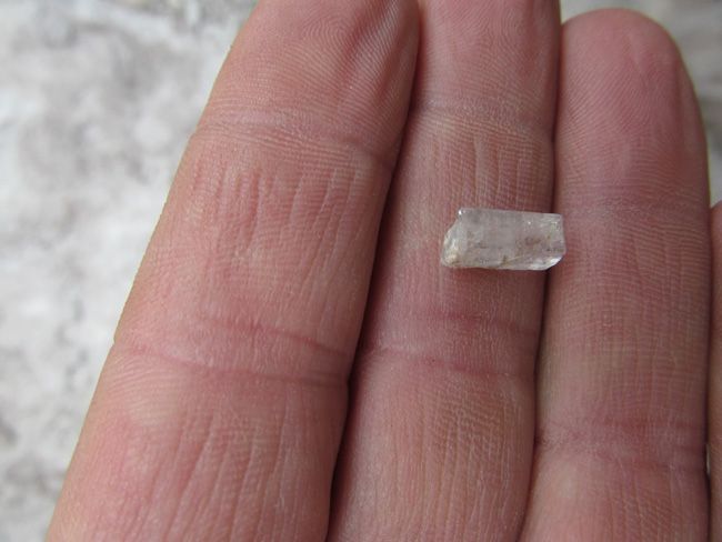
TOPAZ found

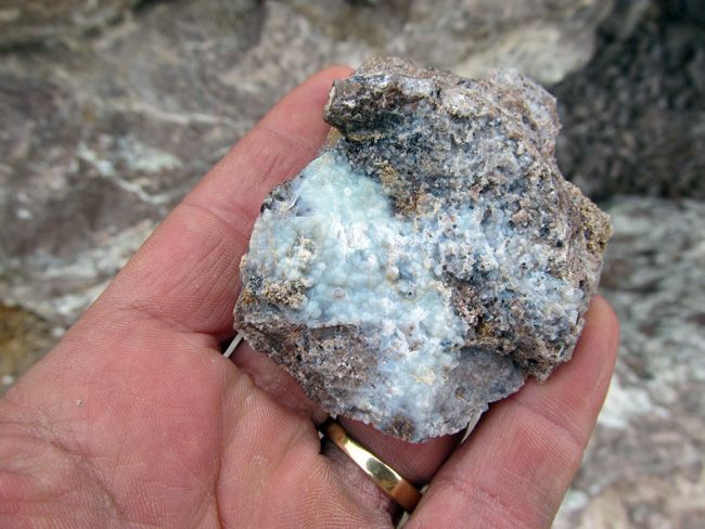
TOPAZ sample found


    TOPAZ sample found     


TOPAZ sample found

(This sample was found on a nearby claim)

 3D


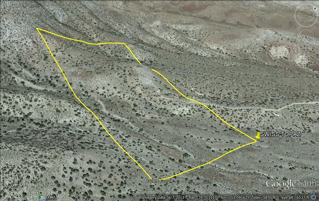
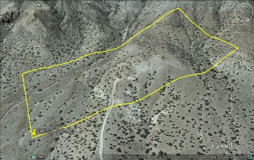
   This claim has an elevation that ranges from 5490-5900 feet above sea level.


3d

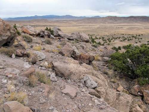
area 

Buyer will receive the following with their completed transaction:

  • Quitclaim deed showing full ownership of the claim. This will be stamped, recorded and verified with the County and the BLM offices.
  • Welcome packet with all of the rules and regulations as they relate to the State and BLM where the claim is located.
  • Educational documents to annually renew your mining claim with the BLM.
  • A CD of all of the documented images of the claim including maps of the site.
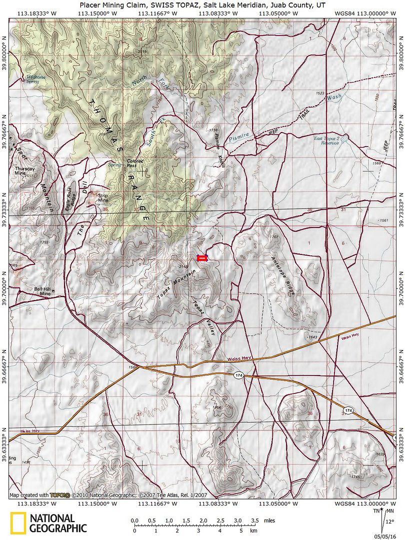
  • Map of claim marked and GPS coordinates.
  • Multiple maps showing claim location and surrounding areas for access.

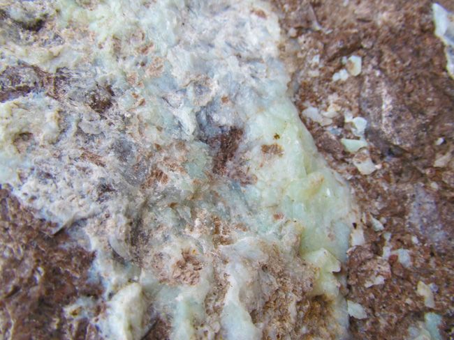
sample sample  

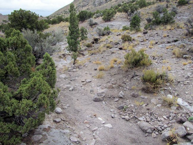
There are several areas within Topaz mountain available for easy collecting of clear Topaz, you may also chance upon small amber colored Topaz. Our team actually found a few small amber colored Topaz as well as the clear Topaz. 

sample sample

Come to Hike, Camp, Ride and Shoot – or come to pull some shiny rock$ out of the ground;-)

Camping:

Antelope Valley RV Park – 36.4 miles  

Yuba State Park – 66.2 miles  

Jones High Country RV Camp – 66.56 miles

Chicken Creek Campground – 71.05 miles  

Big Mountain Campground – 72.10 miles  

Cottonwood Campground – 72.7 miles

area

area area 

As the largest company in the mining industry selling legitimate and valuable historic claims, you can rest assured that you are not only covered with our 100% lifetime money-back guarantee, but you can also rest easy that there is no fine print on any of our claim auctions telling you will have to deal with any games like being charged phony fees or having to pay inflated “processing” or “transfer” fees. The final auction price for this mine when the auction ends is ALL you will pay.

Here are some tools that you should bring: rock hammer, or regular hammer, screw driver, bags for your gems, hiking boots, hat, sun screen, bug repellant and once again don’t forget the water! Jeans are also a good idea because you will be spending most of your time on your knees, and the rocks are very ruff and jagged.


Topaz Mountain is fun for everyone, from the beginner to the novice. As you enter the Topaz bowl you will find plenty of camping. The lower hills are surrounded by acres of flats so the trailer is no problem. However, for those that choose to tent it, you can pull right up into the heart of the bowl and throw a tent almost anywhere. There is no water for miles so be sure and come prepared, also the road back into the bowl gets pretty rutted, and rocky so if you are pulling a trailer I definitely recommend camping in the lower hills, and you can drive the short distance to the collecting sites. There are also hundreds of miles of roads and trails around Topaz mountain perfect for your ATV’s. ATV’s also make it easy to access some of the rougher roads and get you back into prime collecting locations.

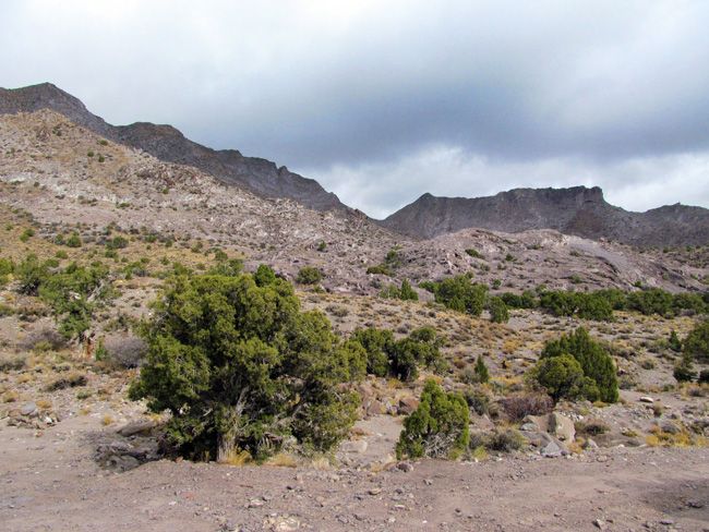
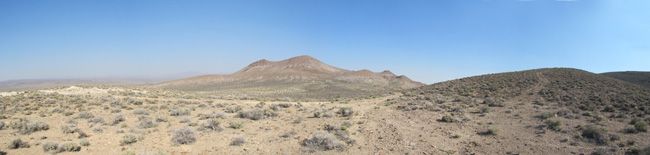
surrounding area   

        surrounding area


 photo 25_zpsge9iobti.jpg


 photo 26_zpstkpgpbp9.jpg


 photo 27_zpsoe1hluhj.jpg


 photo 28_zpsl17vcsbe.jpg


 photo 30_zpsigzanp1y.jpg


 photo 31_zpsjdycuguo.jpg


 photo 32_zpsqghvj1pg.jpg


 photo 33_zps5042lrfs.jpg


 photo 34_zps22w6m2lp.jpg


 photo 40_zpsqm16qmmn.jpg


 photo 41_zps1rskq5kw.jpg

Some of the earliest mining in the state took place within this county. The “heyday” of the Juab County mining ran from 1870 to the 1920’s. Some $40 Million or more in mineral wealth being taken from the various underground workings. Silver, gold, copper, lead, and zinc made up the bulk of those values but other minerals contributed to the number as well.

Juab County is located in west central Utah, and is home to a number of mining districts, including the largest and most productive the Tintic District. Total area of the county is 3,412 square miles. The county seat is Nephi, and the terrain runs from sage covered deserts to tree covered mountain peaks. Mining began with the discovery of precious metals in 1869 and continues to this day, though at a much smaller level.     

Closest Cities/Places Nearby:

Black Rock Pony Express Station – 16 miles  

Dugway Geode Beds – 13.74 miles    

Sutherland – 32.06 miles      

Dugway Proving Ground – 34.42 miles        

Hinckley – 34.25 miles        

Delta – 36.03 miles        

Lynndyl – 39.57 miles         

Sevier Lake – 41.29 miles              


 photo 11_zpseiqzn1th.jpg      


 photo 12_zpsmoyazgyk.jpg


 photo 13_zpsyqkdwozx.jpg


 photo 16_zpsvcvrflni.jpg


 photo 17_zpskd79wejx.jpg


 photo 18_zpscjp5yxe5.jpg


 photo 19_zpsye5ly6as.jpg


 photo 20_zpscoi0rt1r.jpg


Climate

The average temperature of Juab County is 50.04°F, which is about the same as the Utah average temperature of 49.55°F and is lower than the national average temperature of 54.45°F.

Juab County, Utah, gets 16 inches of rain per year. The US average is 37. Snowfall is 69 inches. The average US city gets 25 inches of snow per year. The number of days with any measurable precipitation is 82. On average, there are 226 sunny days per year in Juab County, Utah. The July high is around 91 degrees. The January low is 17. Our comfort index, which is based on humidity during the hot months, is a 65 out of 100, where higher is more comfortable. The US average on the comfort index is 44.

Utah’s four-season climate is stimulating and healthy. The state’s altitude ranges from a low 2,200 feet in Washington County to more than 13,500 feet in the high Uintas. Snow frequently accumulates to depths of 10 feet or more at some Wasatch Mountain ski resorts. Because of the state’s inland location, Utah’s snow is unusually dry and fluffy and is acclaimed by many skiers as the world’s greatest powder snow. Like the state of Utah, Juab County enjoys beautiful seasonal weather, the average July temperature is 76.1 degrees Fahrenheit and average January temperature is 29.2 degrees. Juab County receives an average of 13.5 inches of precipitation annually, with March being the wettest month. Juab County’s growing season averages 155 days.


 photo 22_zpsoqmwalll.jpg


 photo 23_zpsnbssj3vh.jpg


 photo 29_zpsbqjqpzri.jpg


GEOGRAPHY

Juab County’s elevations range from 4,285 feet at Fish Springs in west Juab County to Ibapah Peak of the Deep Creek Range which stands at 12, 087 feet, in the west desert near the Nevada border. Mt. Nebo, in the Wasatch Mountain Range, reaches 11,928 feet in east Juab County. The two mountain peaks are jointed by Rich green valleys containing fertile farmlands and vast desert lands with acres of free moving sand dunes.

Juab County is a part of the Basin and Range physiographic province. Most of the fertile farming land in the county is located in the Juab Valley near Nephi at the base of Mount Nebo (11,877 feet). The western portion of the county consists of broad, semi-arid valleys and low desert mountains. The Wasatch Mountains are located to the east, and moving west there are the East Tintic Range, West Tintic Range, Thomas Range (Topaz Mountain 7,113 feet), Fish Springs Range, and the southern tip of the Deep Creek Range in the extreme northwest corner of the county.  

area


area

History 

On the other side of the mountain, another large discovery was made. The extent of the mother load was so large, it was named Mammoth, and a city grew there also.   

The history of Juab County changed forever in 1869. Eureka! Suddenly the word gold was on everyone’s lips. Large gold nuggets were found in the Tintic Mountains, and hundreds moved in to stake their claims. By 1870 the tent city was called Eureka. Sunshine Mine, with its mother load of rich ore, produced millions of dollars in gold, silver. Lead and other metals.


Today you can relive the past by visiting the places where gold was king. Start at the Tintic Mining Museum in the town of Eureka. You can view old mining equipment and get info about areas you may want to visit.


The bulk of mining activity was centered in the eastern portions of the county as transportation costs from the more remote western locations made mining of lesser grade ores


area


From Nephi, Utah, travel 33 miles southwest on State Highway 132 to Lynndyl. Turn south on U.S. Highway 6 and drive for approximately 5 miles. Turn west on the Brush Wellman road and travel 38 miles until you reach the Topaz Mountain sign. Turn north on the dirt road and drive about 2 miles, then turn west toward Topaz Mountain.

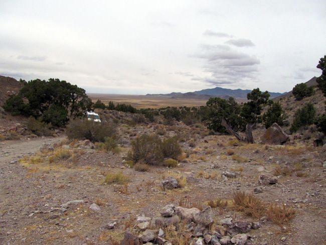
The main road leading you to the claims is UT-174. This is a paved road and it takes you almost right to the claim. Once you reach the dirt road that takes you the rest of way, you will have a very easy drive. No need for a big four-wheel drive, 2-wheel will be just fine. There are few turnouts around the claim, which makes for easy access for parking a small trailer or camper; as well as being able to go back and forth between working and grabbing tools.


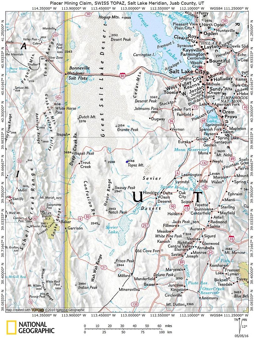
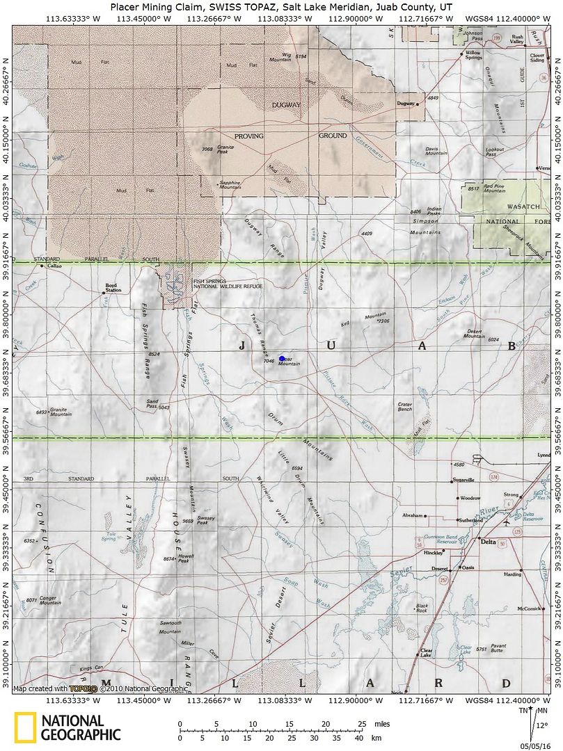
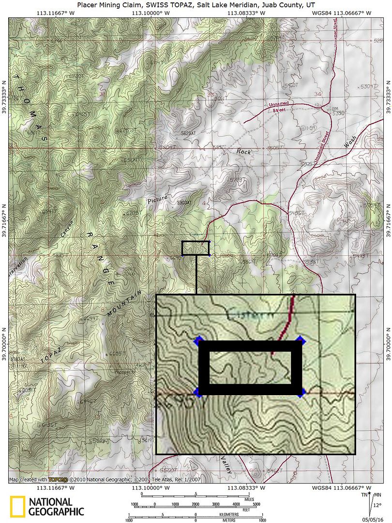
TOPO MAP


TOPO MAP


topo map    


TOPO MAP

Mining claims are a tangible asset just like any other Real property (real estate) and show a lifetime proof of all interests in minerals in the area specified by the above claim. Once you own this claim and the associated mineral rights, you will own them for life as long as you keep up with the annual fees. This claim can be bought, sold, leased or used as collateral, just like any other piece of real estate.    
A mining claim can be willed or passed down to future generations as part of a trust or your estate, or you can trade it, lease it out for a period or time (or indefinitely), gift it to a family member or friend and you can also transfer or sell just an interest in it in part or in its entirety just like any other real property using a quitclaim deed which is a recordable conveyance. In other words, you could sell a 25% or a 50% share in it if you wanted in order to bring on a partner in the future – or you could sell the entire claim in whole.

This is for full/all interest in this 20 acre placer mining claim (unless the acreage indicated in the above mine description is different). This claim covers the entire site, (unless the claim description above describes different measurements), and includes full rights to all minerals, gems and just about whatever else you may find of value on the property (except oil and gas, which are handled separately). You will receive a notarized quitclaim deed to the full claim and all associated documentation showing full ownership of the claim. We pay ALL fees associated with transferring this claim into your name – legal fees, title transfer fees, document fees, notary costs, recording fees and even shipping fees, so all you will pay is the final price of the auction, not a penny more.

In order to hold on to your claim for life, you will need to pay an annual maintenance fee to the Government (BLM, not us) every year.  Currently the maintenance fee is $165 per year per claim that you own, and it is due on September 1st of every year.  

NOTE that if you own fewer than 10 claims nationwide, we can assist you in filing the paperwork to waive the maintenance fee every year. That means you will only pay $15 per year for your maintenance fee instead of $165.  

We guarantee that all past fees have been paid in full and there are no outstanding debts or amounts owed on the claim prior to the transfer of ownership into your name.

The federal government retains ownership of the land – so this means that you will not have any annual real estate taxes due on your mining claim, and you will not have to maintain liability insurance in case someone gets injured on your claim due to no fault of your own.

How do Transfers of Ownership in Mining Claims work if I decide to sell my claim in the future?

First, we handle all the paperwork and costs associated with transferring this claim into your name should you win this auction. But if you decide to sell this claim at some point in the future, interest in a properly recorded mining claim or site may be transferred (i.e sold) in part or its entirety. A quitclaim deed or recordable conveyance document is required and if you do sell your claim someday and the transfer documents should be filed within 60 days after the transfer.

We can and will help you with the paperwork for no cost should you need a hand selling your claim in the future if you pay all of the County, State and Federal fees (usually less than $40 to $60).

But again – with regard to transferring this claim initially into your name, we take care of all the paperwork at our expense. You do not have to worry about anything. we handle the BLM transfer documentation and the county recording.                                                                                                                                                 

Can you build / camp on your claim?  

Without an approved plan of operations, you have the same rights and restrictions as the public. If the area is open to camping to the public, then it is permissible. However, you need to check with the BLM Field Office or the local District Ranger for areas open to camping. Under Federal law in order to occupy the public lands under the mining laws for more than 14 calendar days in any 90 day period, a claimant must be involved in certain activities that (a) are reasonably incident; (b) constitute substantially regular work; (c) are reasonably calculated to lead to the extraction and beneficiation of minerals; (d) involve observable on-the-ground activity that can be verified; and (e) use appropriate equipment that is presently operable, subject to the need for reasonable assembly, maintenance, repair or fabrication of replacement parts. All five of these requirements must be met for occupancy to be permissible.

Although it is possible to build a permanent structure on a mining claim, it is extremely expensive and you will have to jump through way too many hoops to consider it easy to do. It would have to be in support of a commercial, year-round mining operation for starters, and you would need to post a large reclamation bond to insure that if you ever abandoned your claim, the bond would pay for the removal of the structure and the reclamation or the area. So in short, it is technically possible to build on your mining claim, but just be aware that it is very difficult and expensive to do – however, camping is almost always involved unless your claim is in a wilderness area, which is not very common at all.

Proud Member of:

Your payment of this eBay  item in full gives you 100% ownership of this entire claim, with no other fees and/or other costs for the transfer of ownership required. This is NOT  for the down payment, this is NOT a partnership arrangement where someone else will own part of the claim with you, and there are NO other fees or costs for the transfer of this claim in your name.

eBay does not allow checkout on the eBay website for any Real Estate transactions – simply because it is not like selling a widget – the transfer of real estate is complicated and requires notary work, licensed professionals and recording. Note that this is eBay’s rules and not ours and it is the same for any mining claim seller on eBay      

We also are not able to accept PayPal payments for mining claims, as claims are real estate and PayPal does not allow payments to be made on any real estate items, including single family homes, condos, mining claim or land purchases. We DO accept just about every other kind of payment method you can think of: Personal Checks, Business Checks, Cashier’s Checks, Money Orders, Bank Wires, ACH payments, Direct Bank Deposit at any Bank of America Branch, Gold or Silver Bullion (at the day’s SPOT prices), etc. After the auction close, we will send you a secure link to handle the payment safely online if you prefer, and we can also take care of payment by mail or telephone, as we are a traditional Brick and Mortar business – so whichever method you prefer is perfectly fine with us.

We provide financing plans with no interest or fees. Financing terms are minimum of $500 down with the balance will due within 90-days via three equal monthly payments of the remaining balance after the down payment has been paid.       

With all financing plans, we do not transfer the final deed into your name until the claim has been paid in full. In the event of a default on a payment plan, we do not refund your down payment – however, we do allow you to put that down payment towards any other purchase as a store credit in full. If you are financing a climate and there is less than 90 days until September 1st (i.e. from June 1st through September 1st), when the annual fee for mining claims is due to the Federal Government, we will add the $165 maintenance fee to your down payment and pay it to the BLM on your behalf thereby increasing your down payment to $665 instead of $500 – however, the $165 portion of the down payment does not go towards your principle balance since it is used to pay the annual fees to the government, therefore the actual down payment credit will still be $500.

Approval for financing is automatic as long as you have a valid eBay account in good standing.

Item specifics

Seller Notes
“Who are we? We’re A+ Rated with the BBB. Innovator of the year, 2016 E&MJ. Conservation award …
Type of Claim
placer
Featured Refinements
Gold Mining Claim
Property Address
Silver City, UT, 84628
State/Province
Utah
Seller State of Residence
California
Zip/Postal Code
84628
Zoning
Mixed
City
Silver City
Acreage
20.0
Type
Unpatented Mining Claims
See Map
Portions of this page and links may be provided by third party content providers such as MapQuest.com, and they are solely responsible for such content.